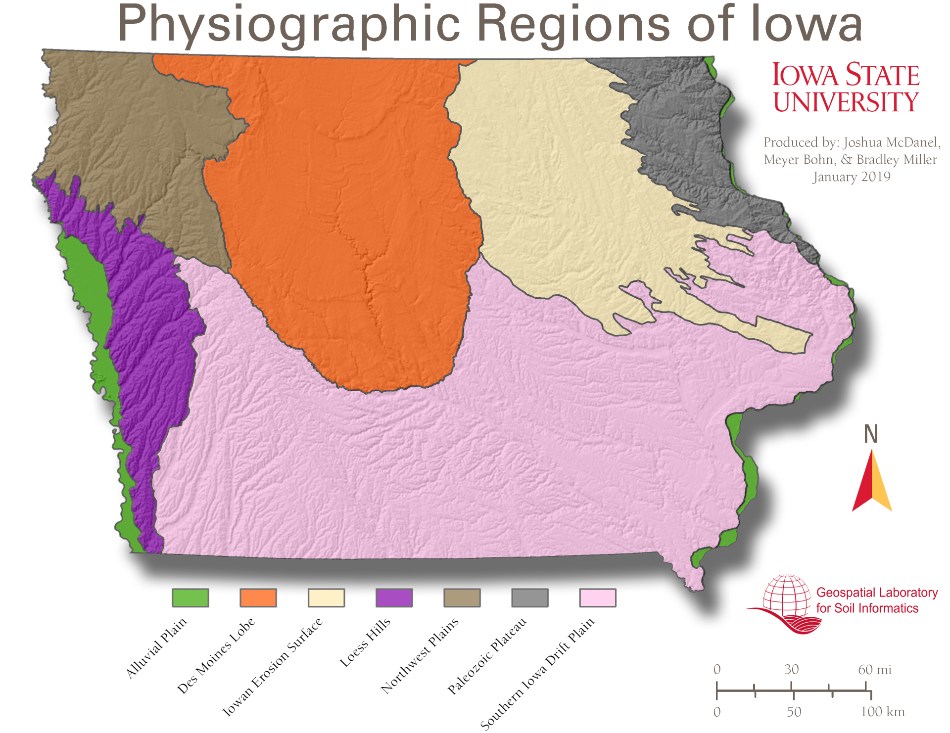
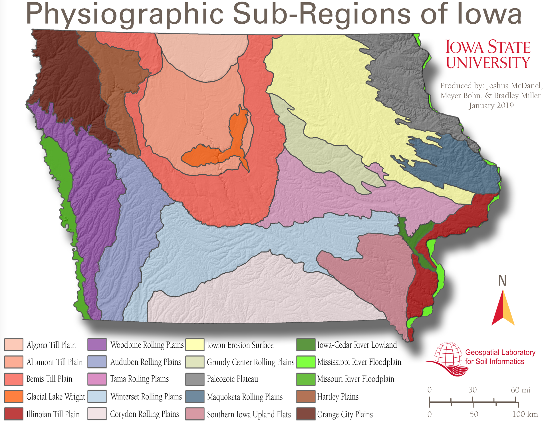
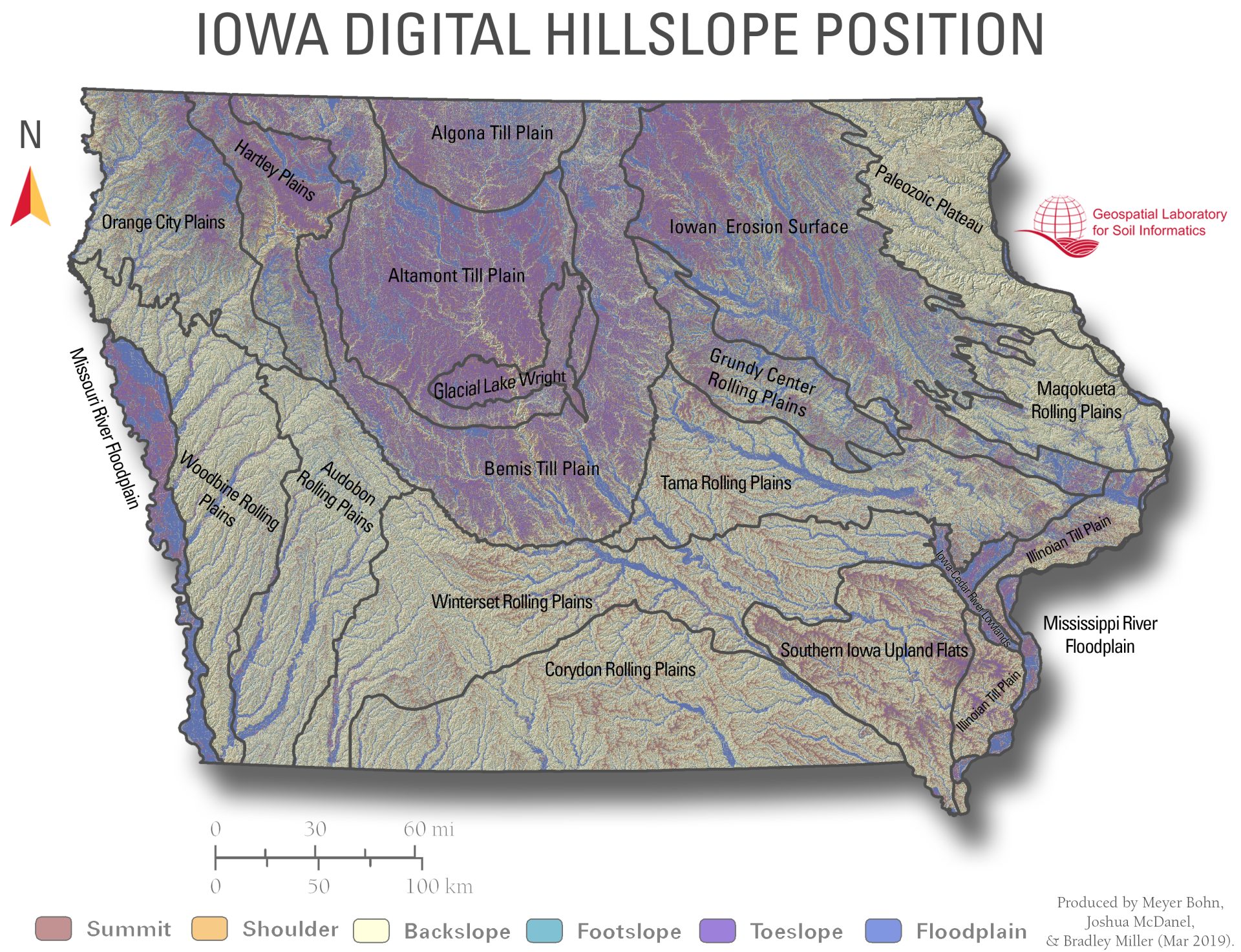
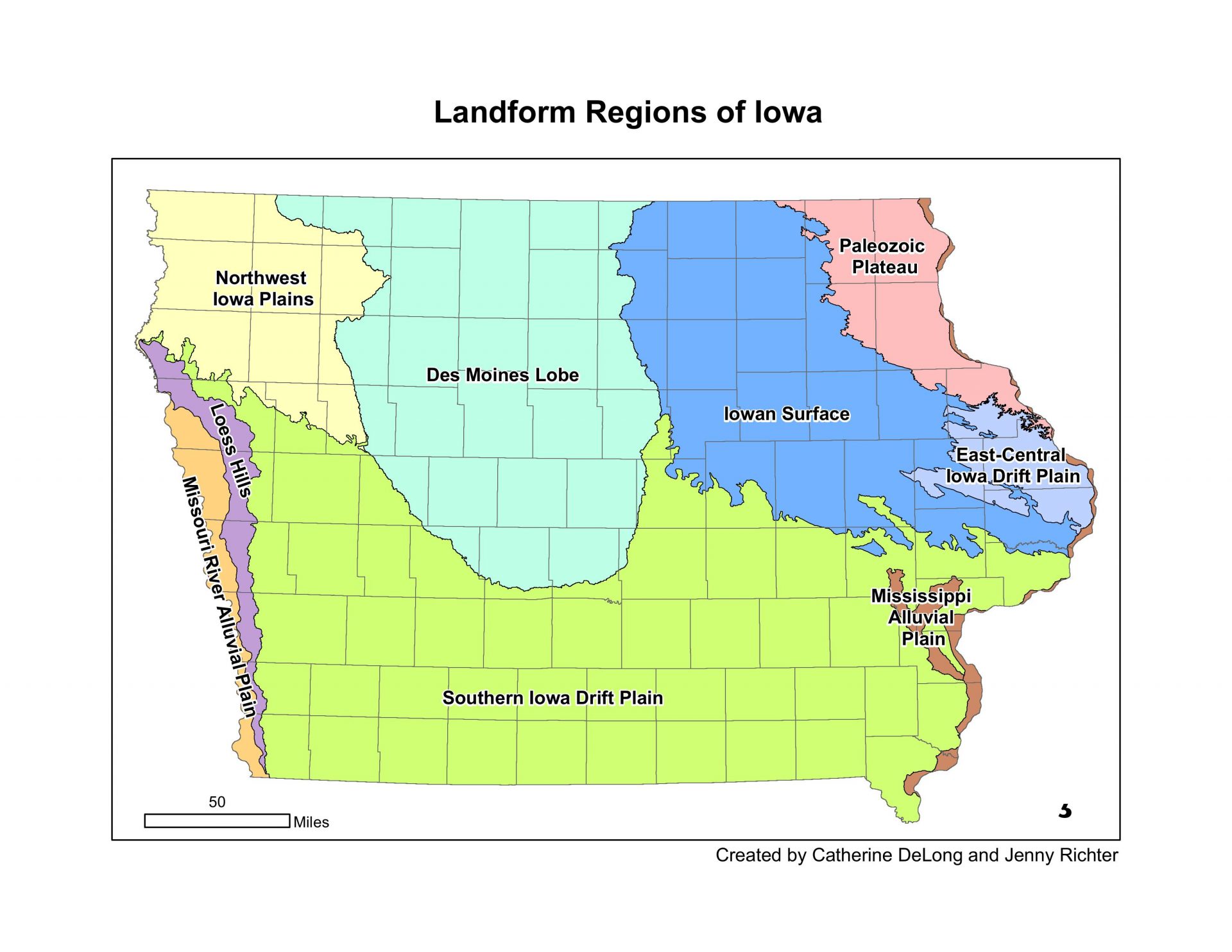
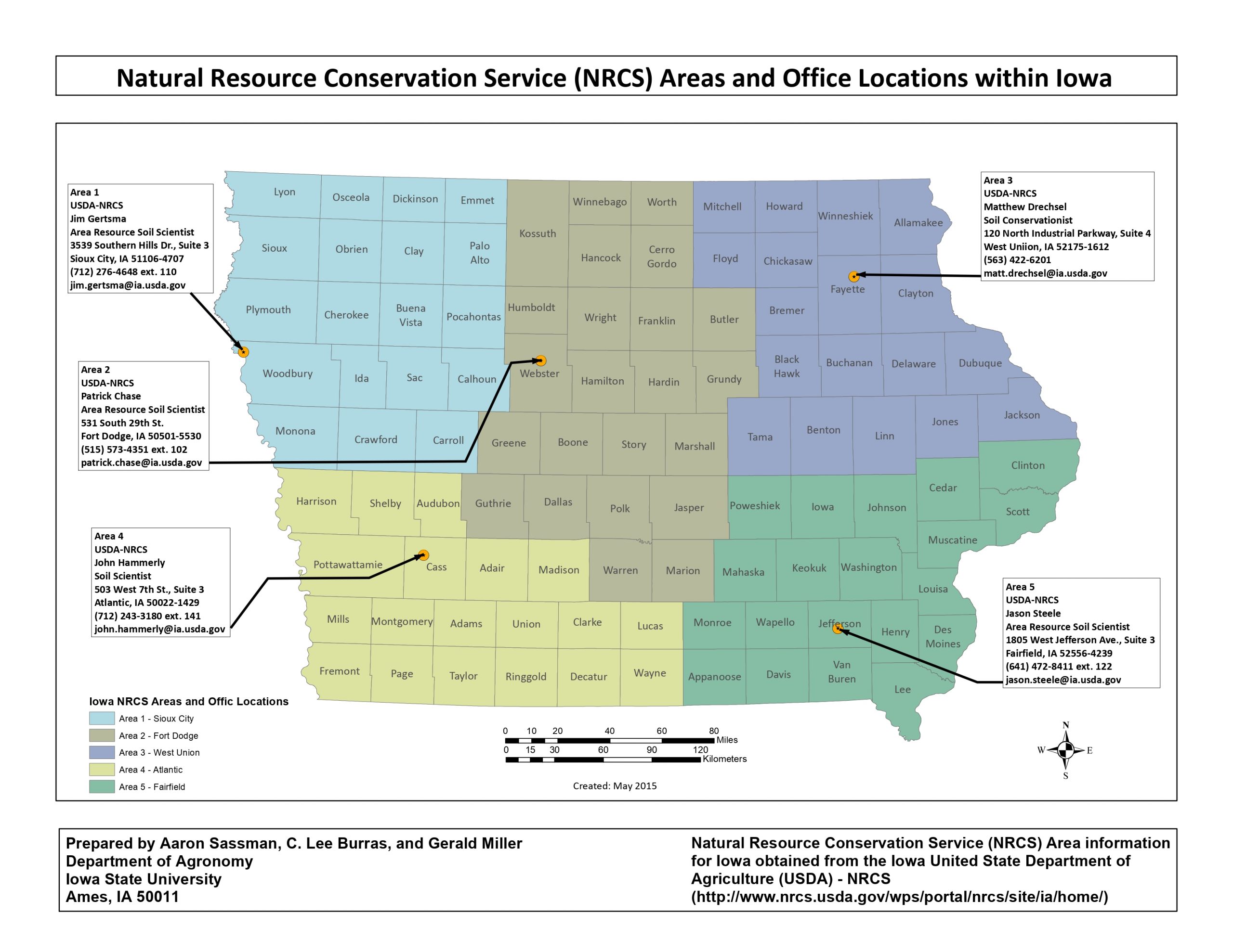
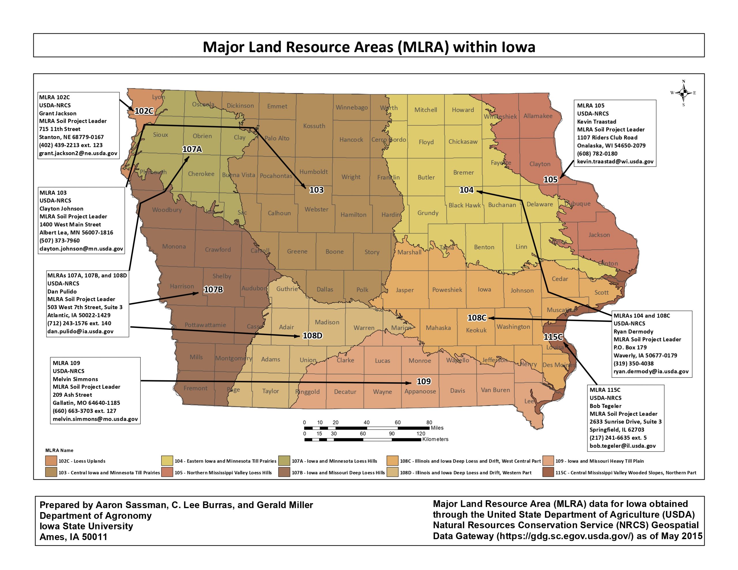
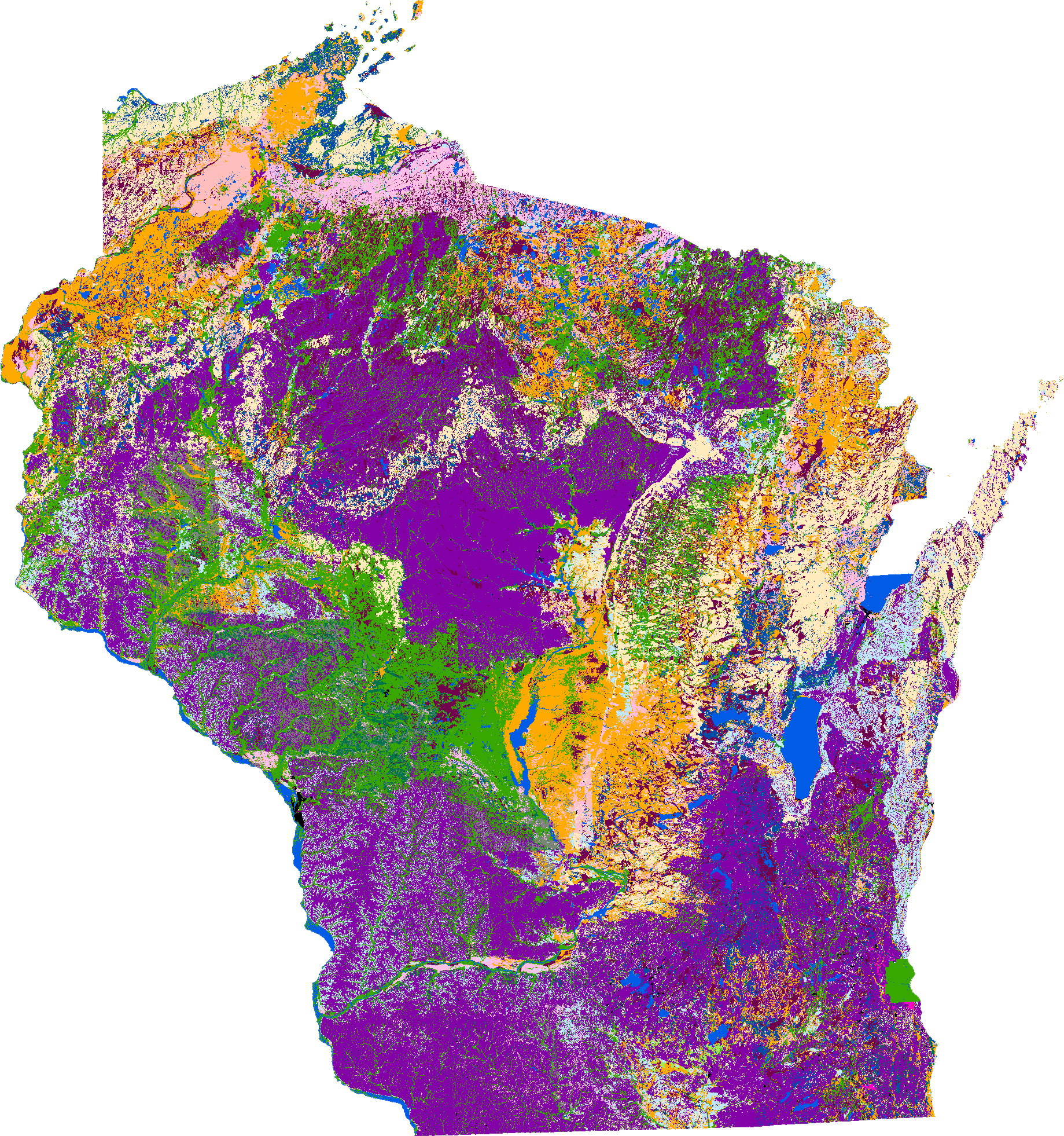
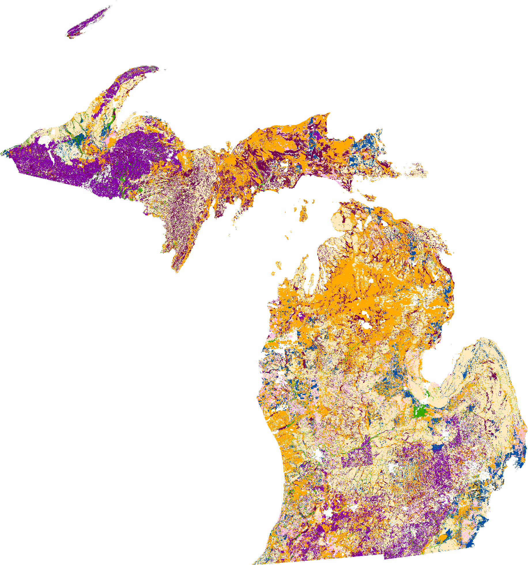
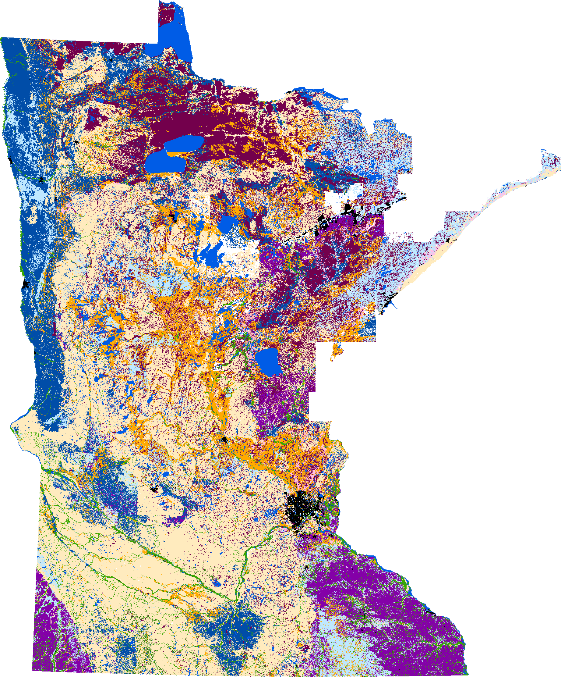
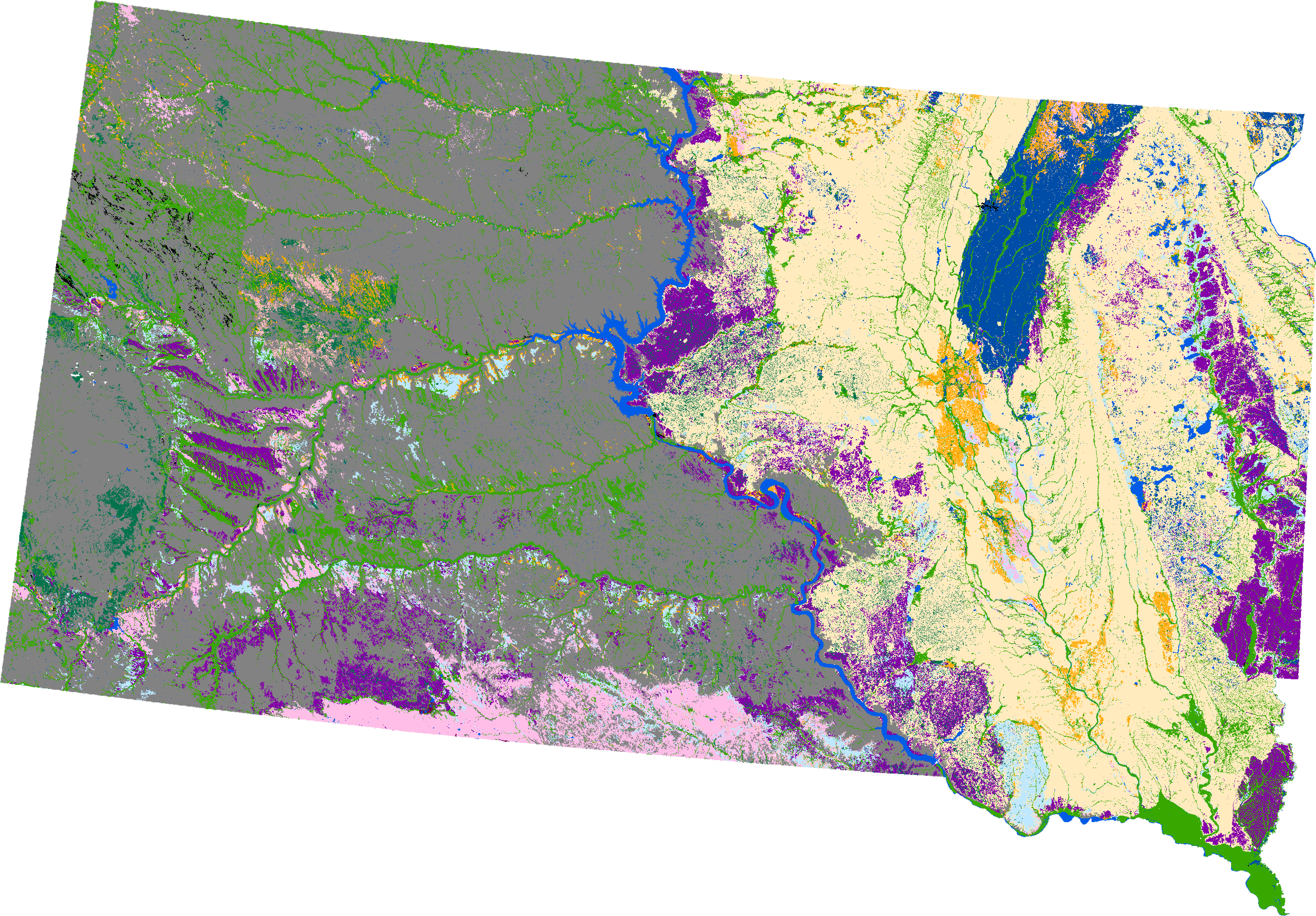
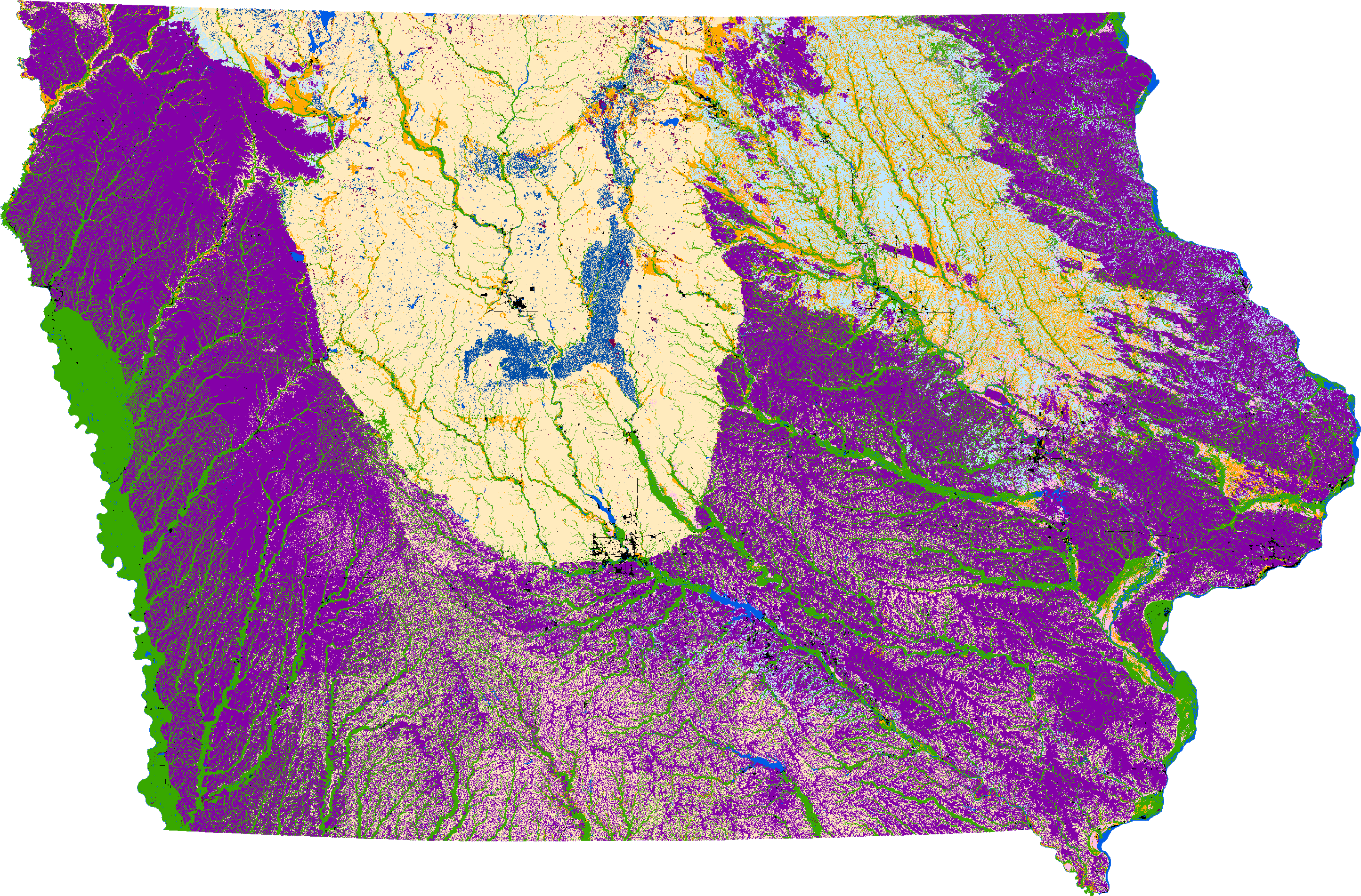
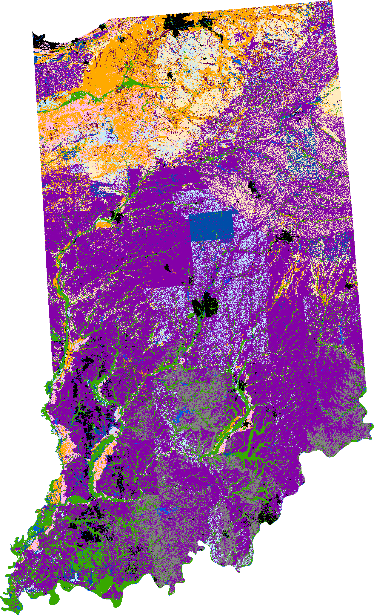
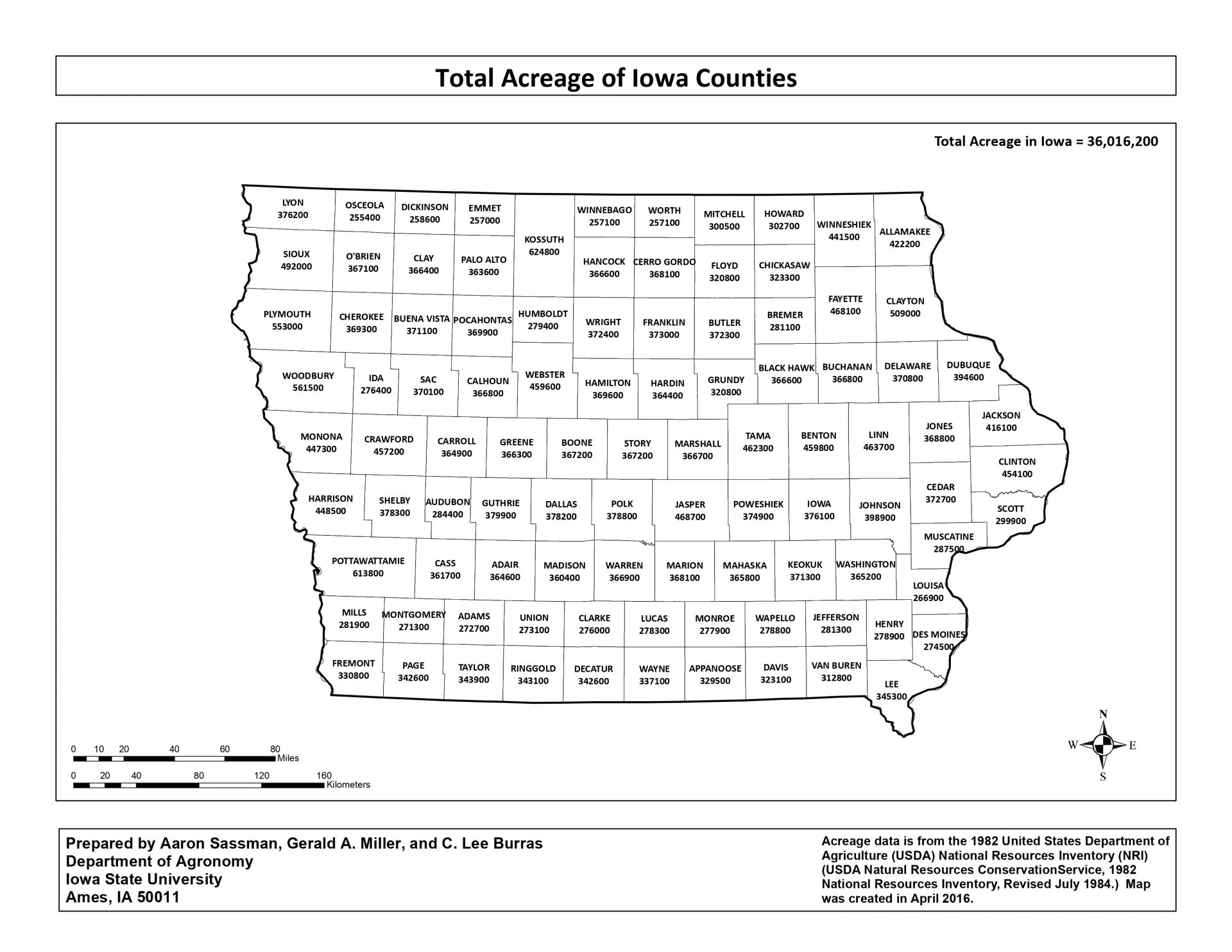
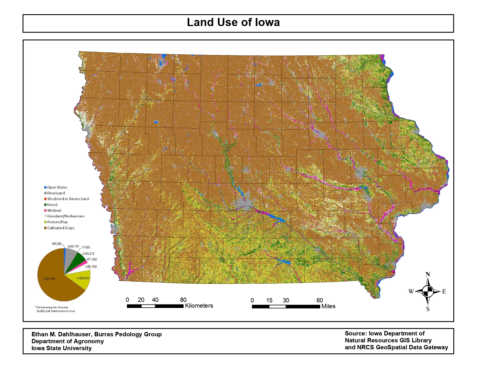
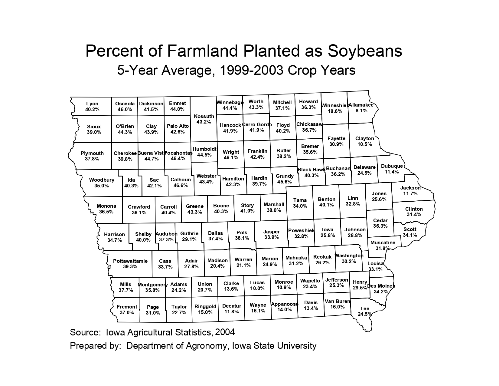
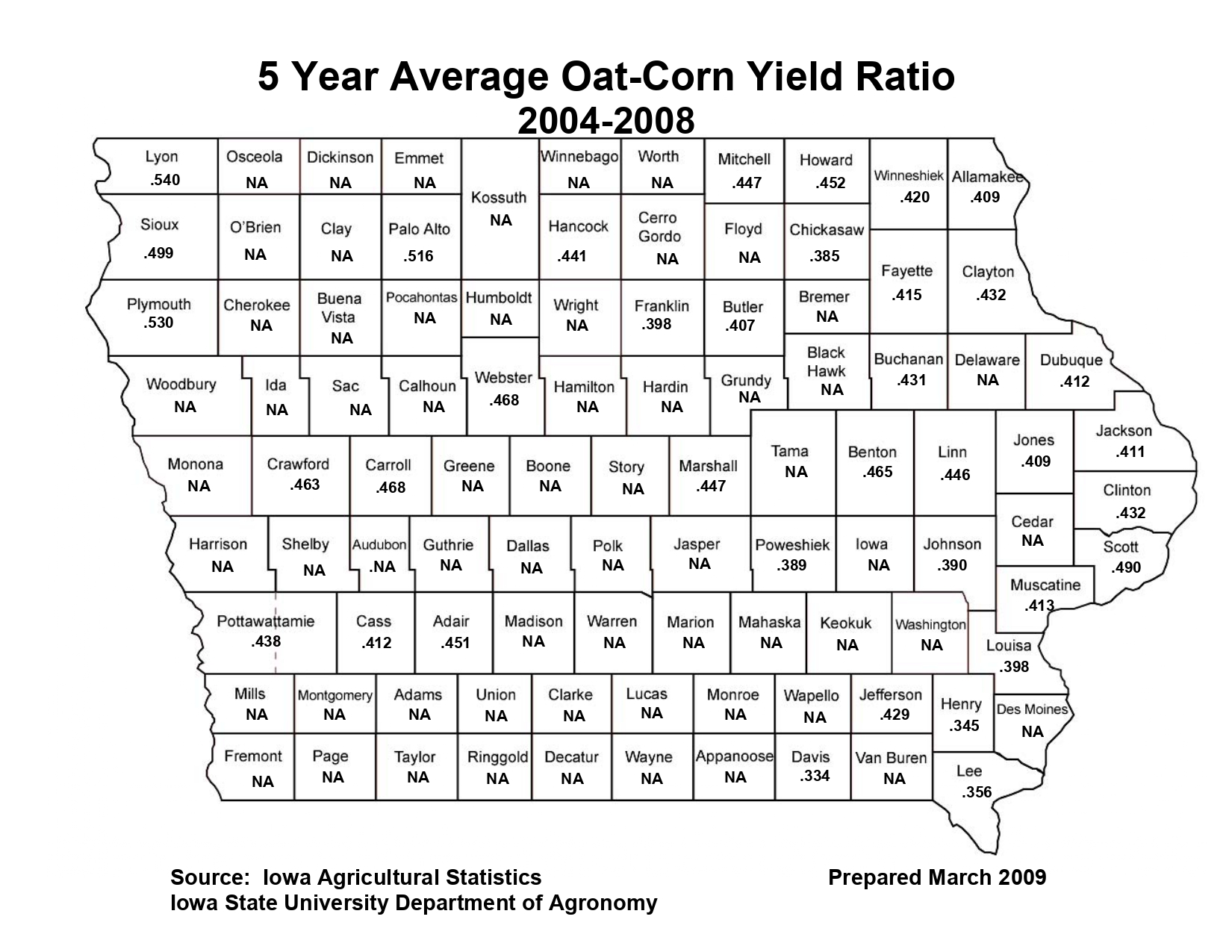
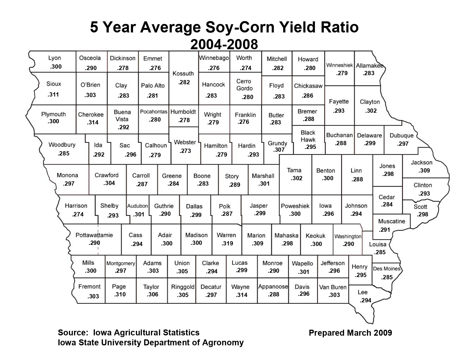
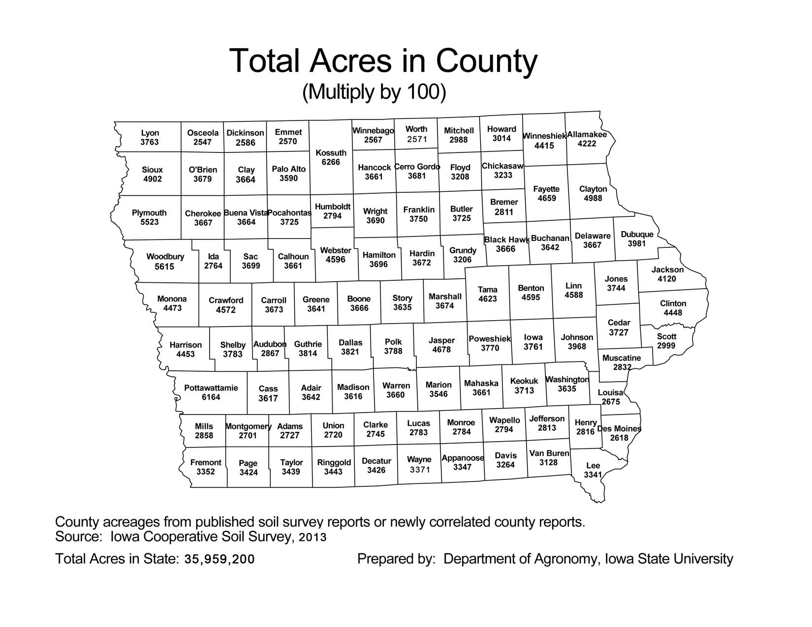
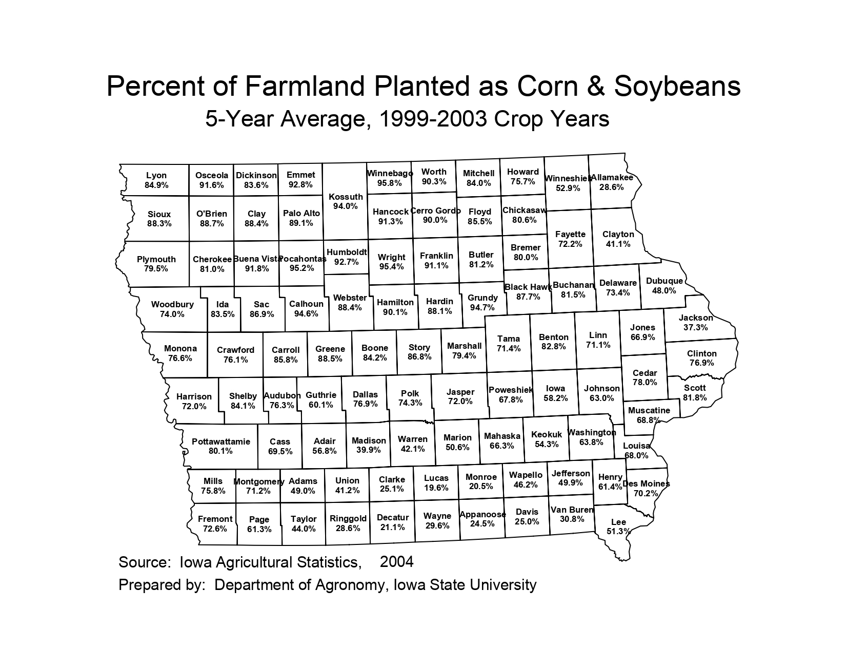
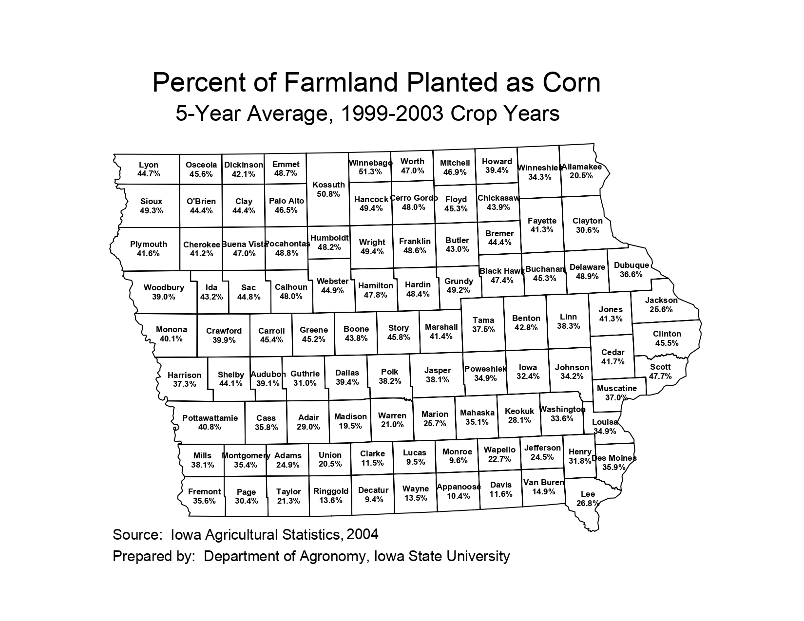
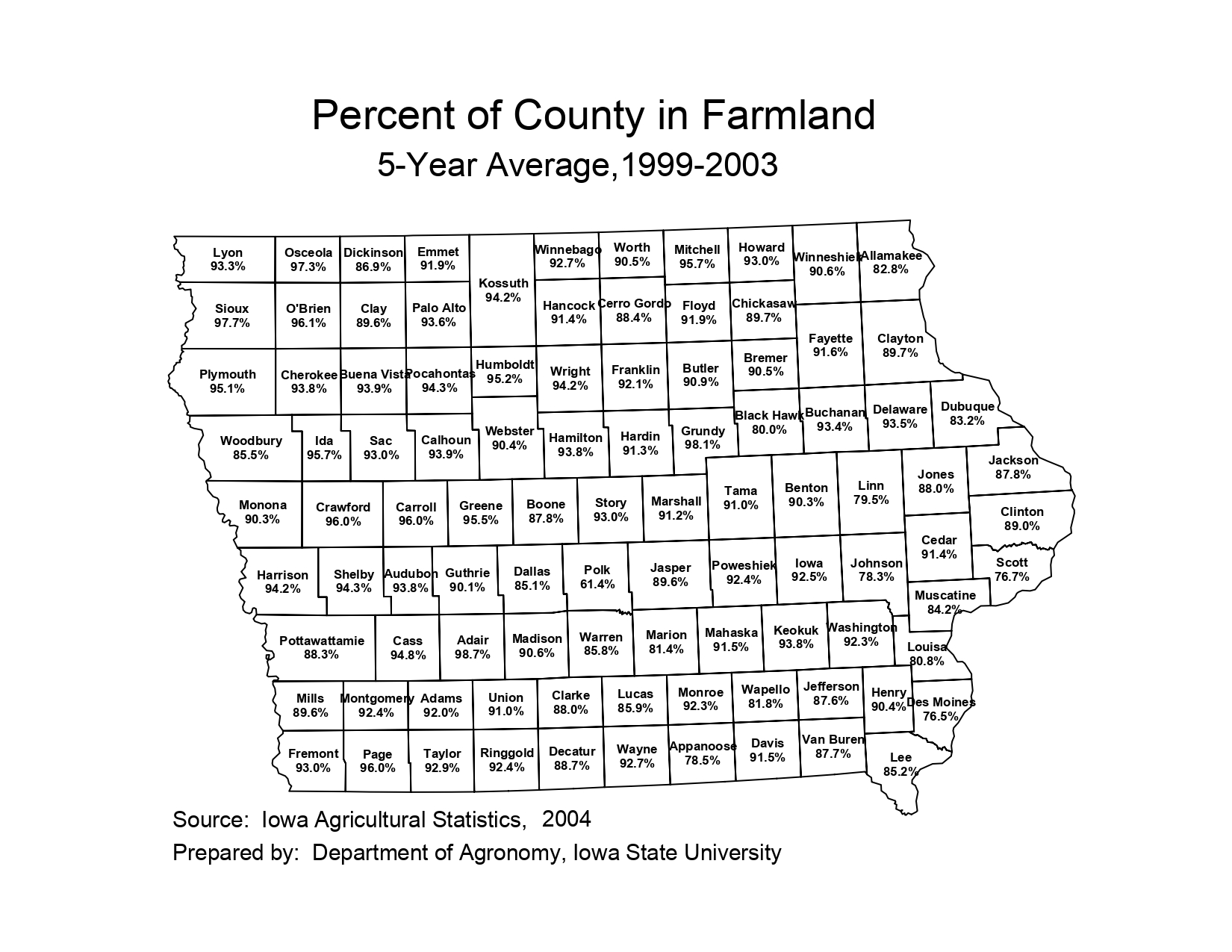
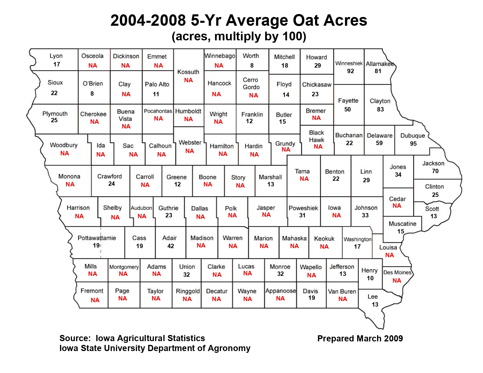
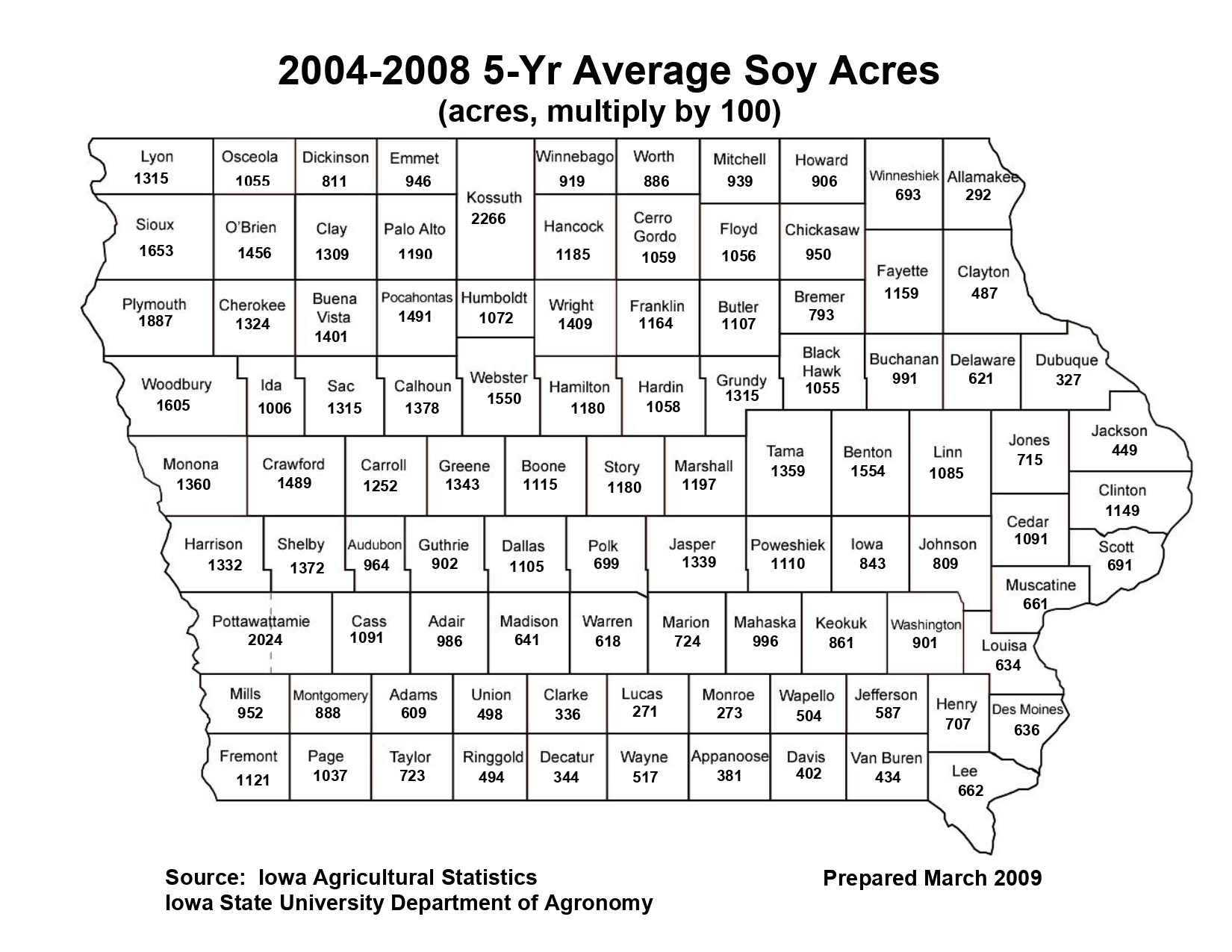
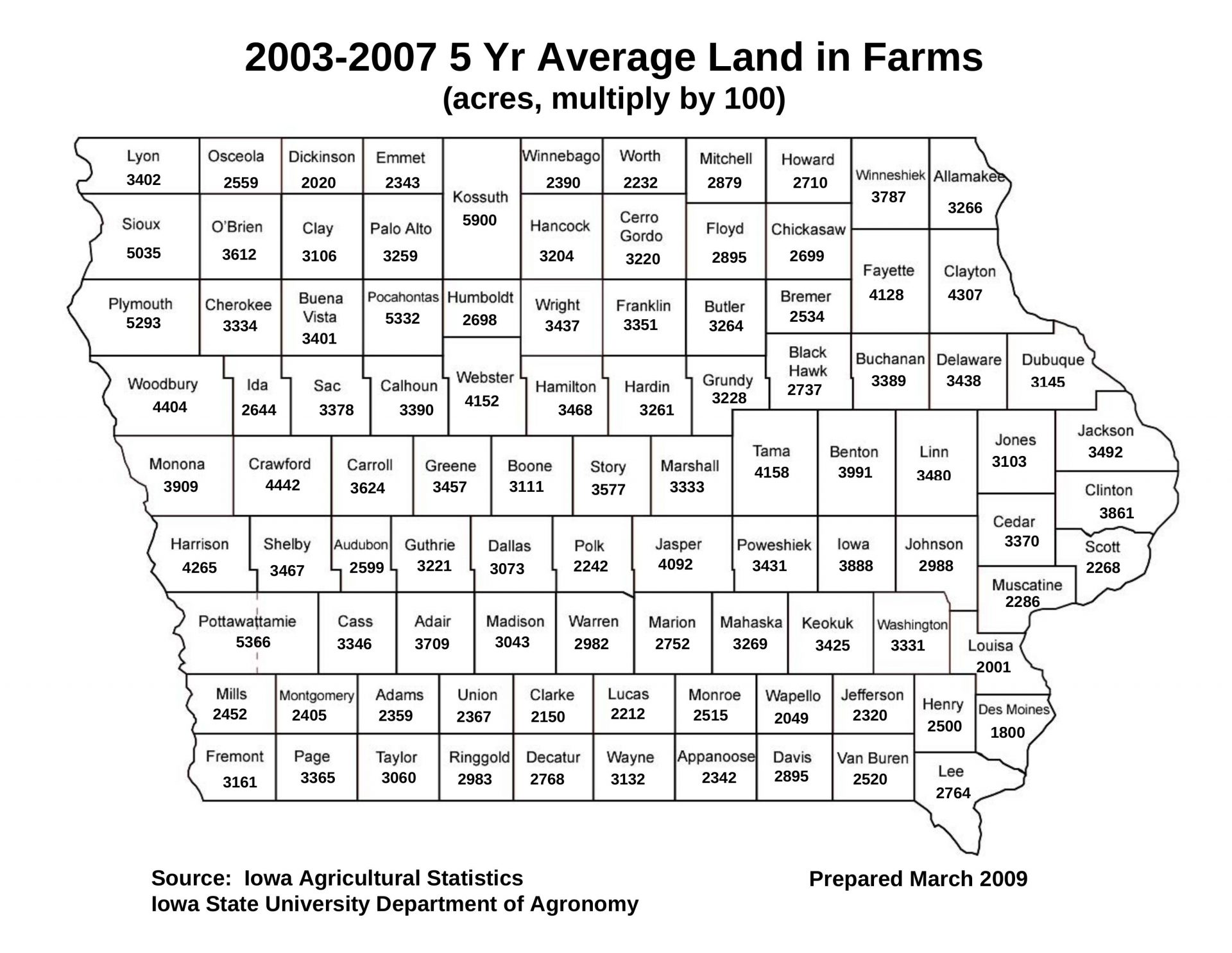
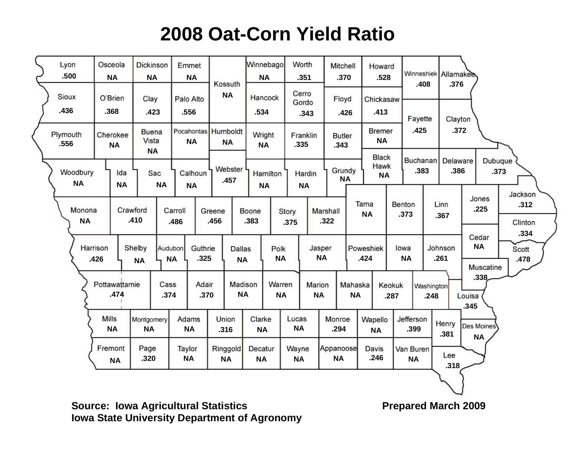
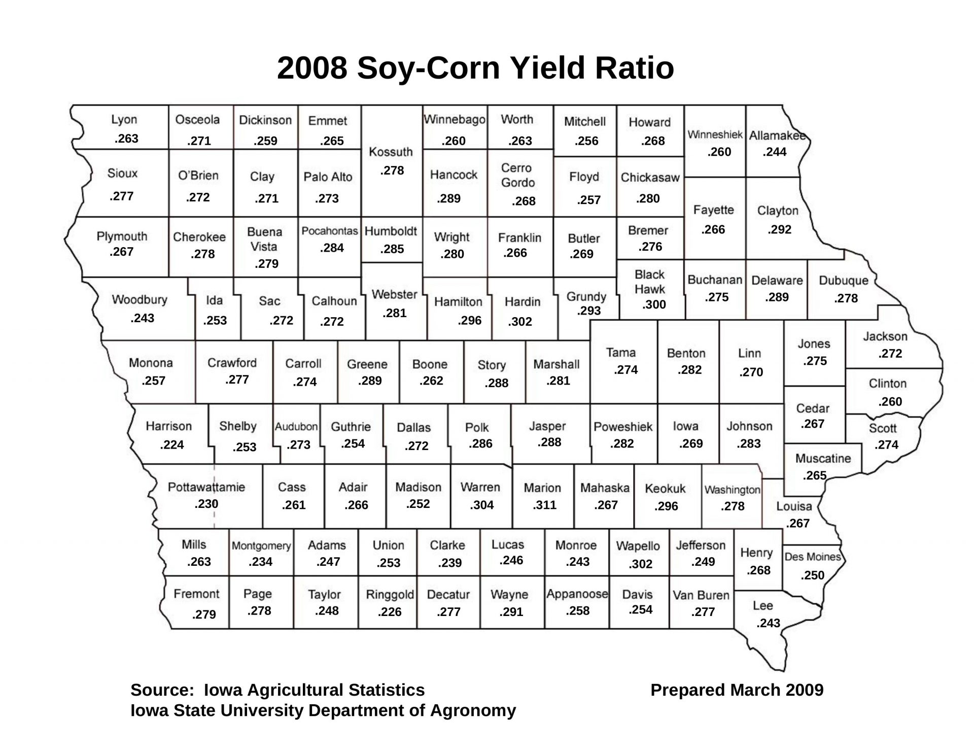
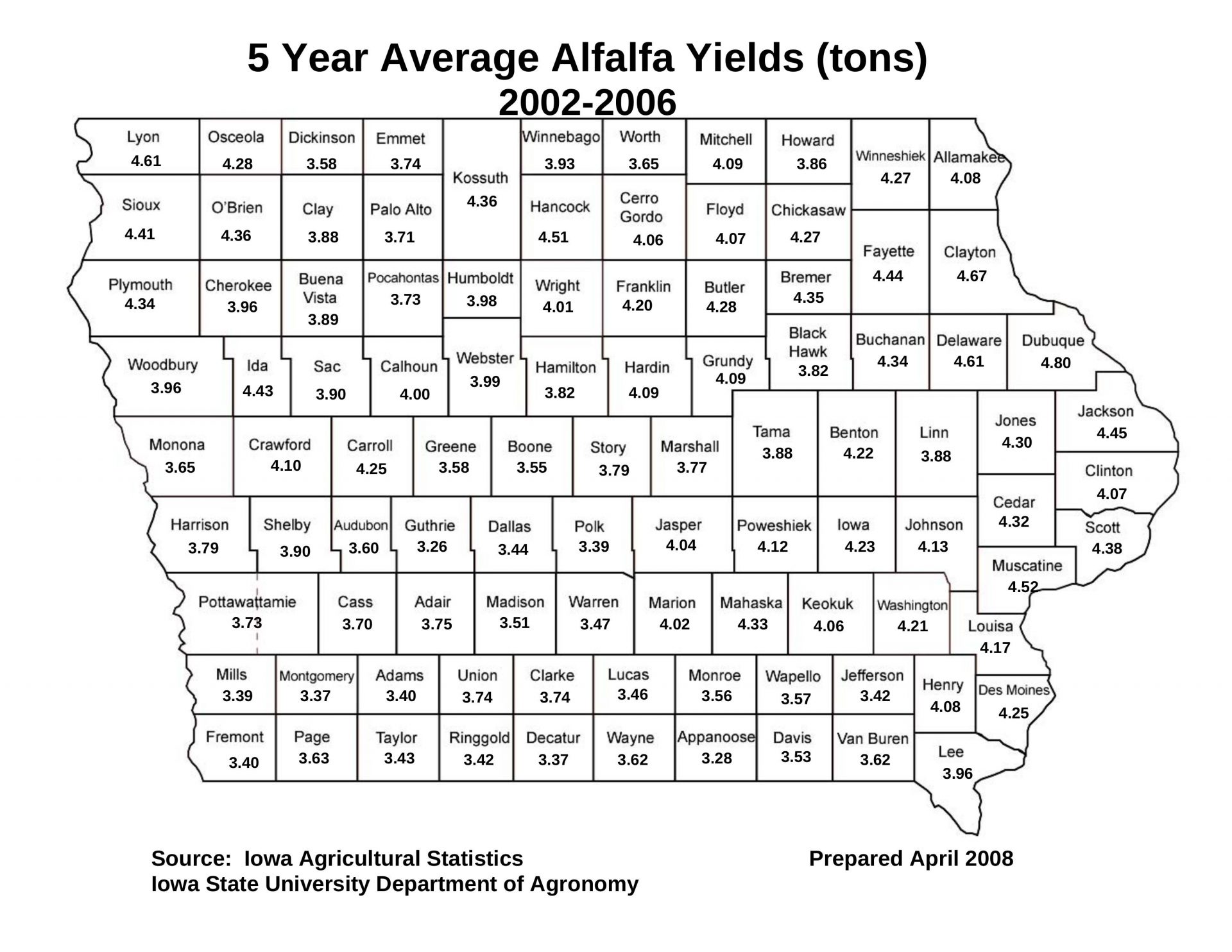
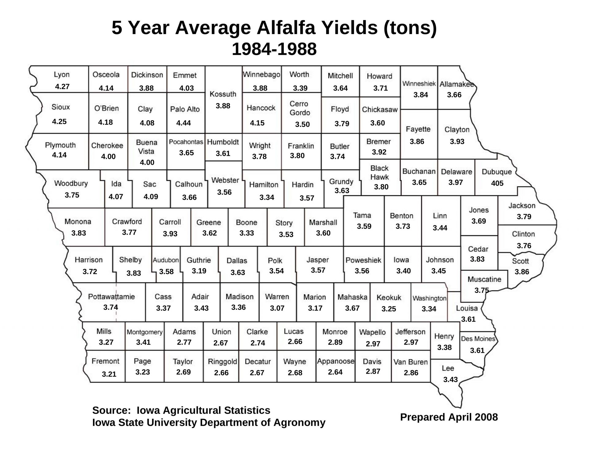
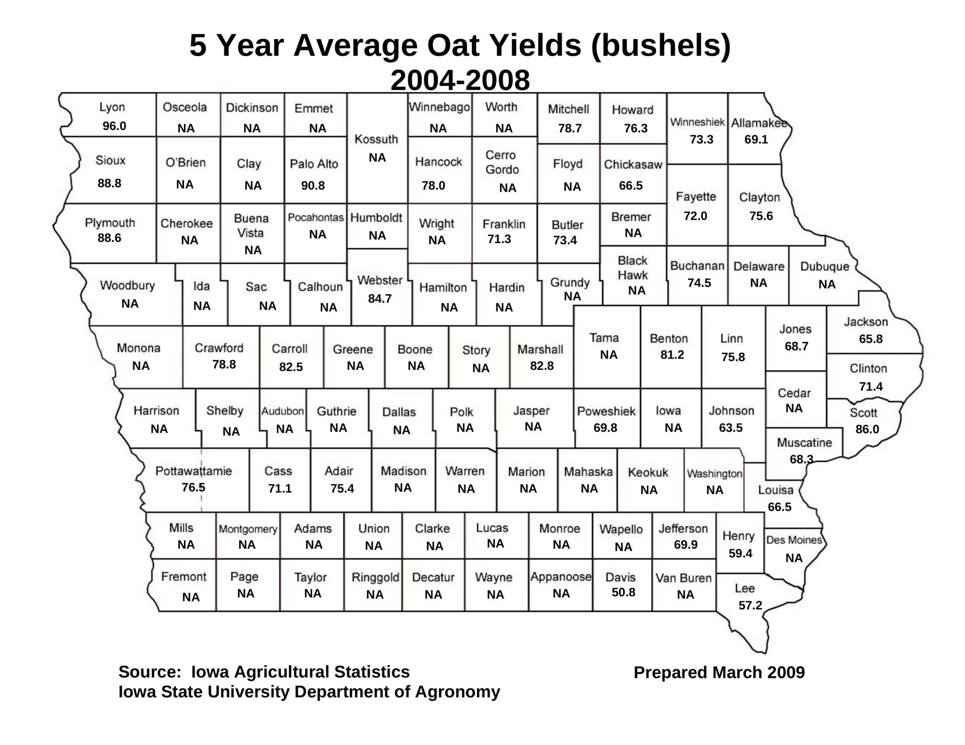
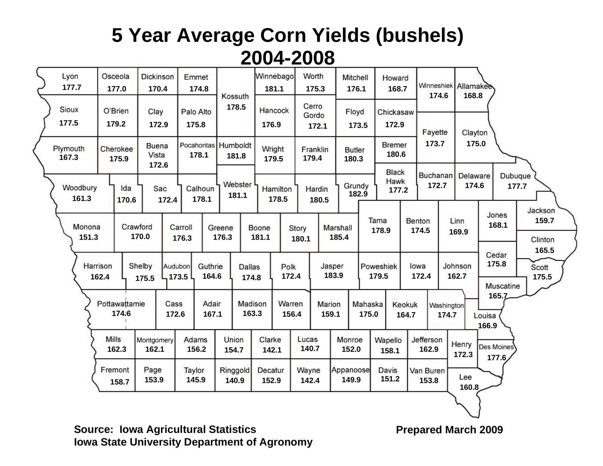
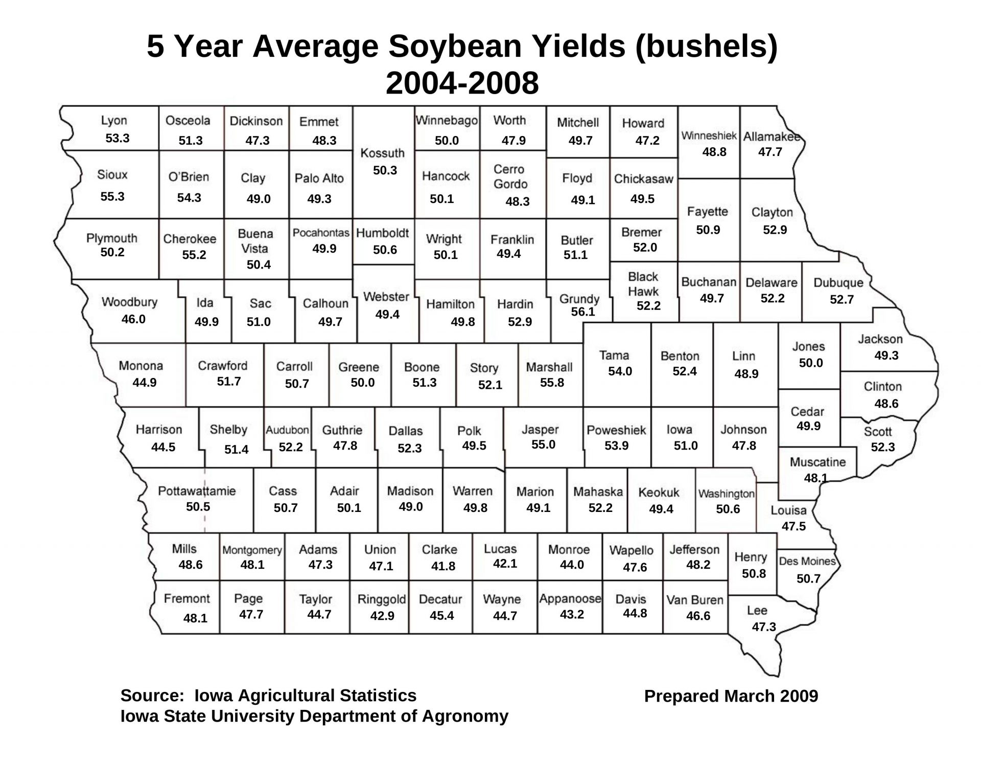
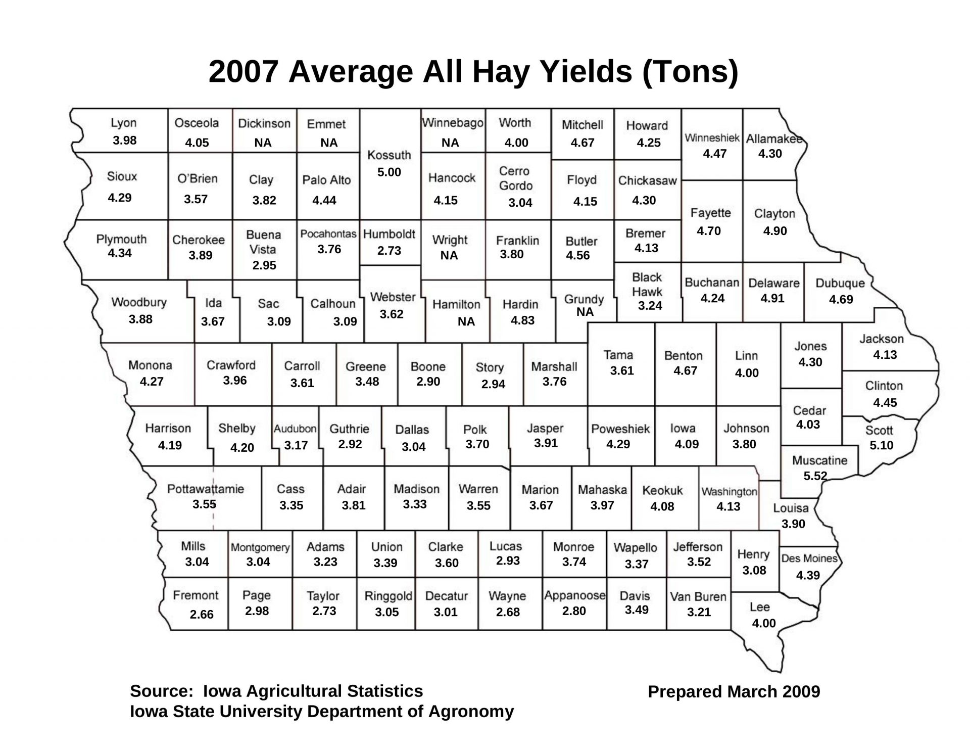
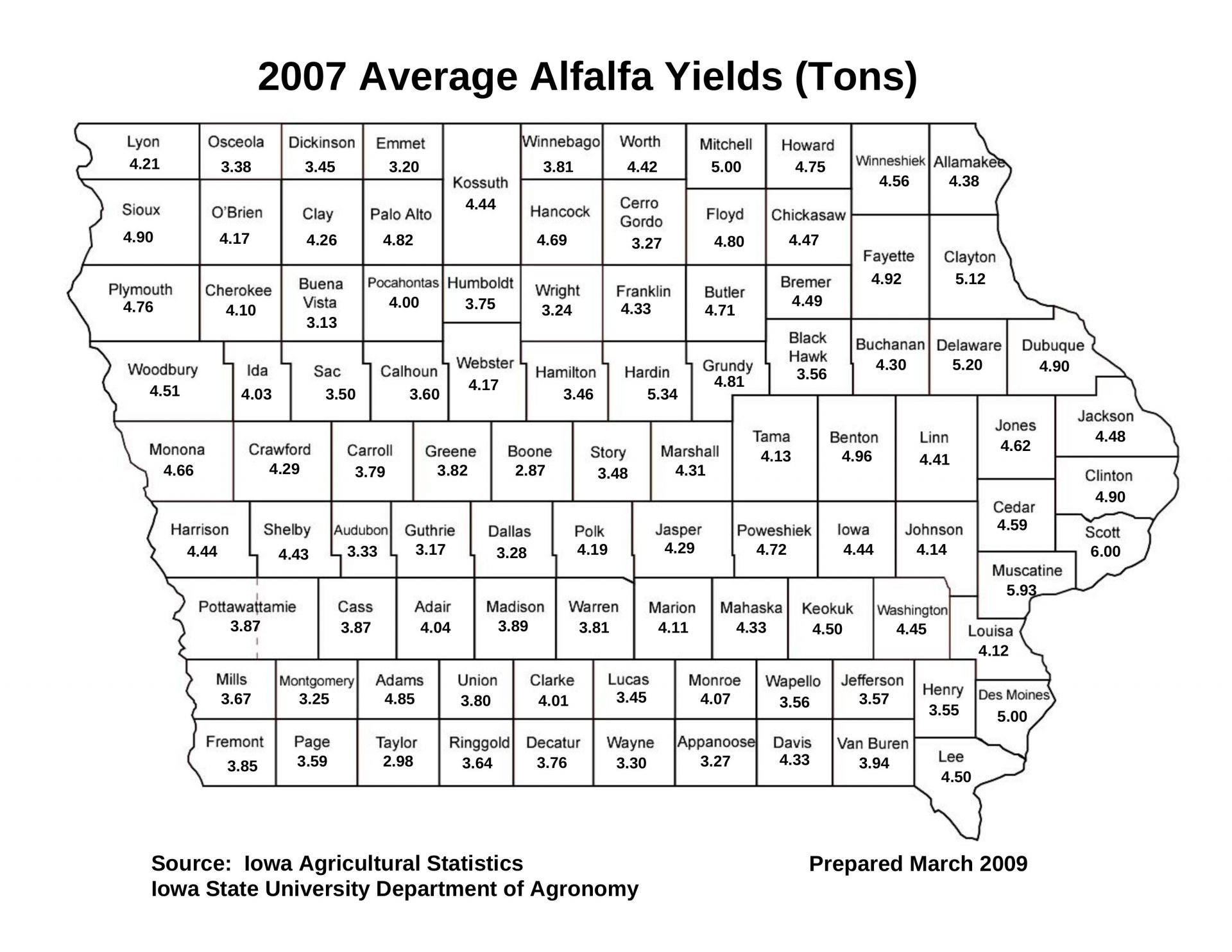
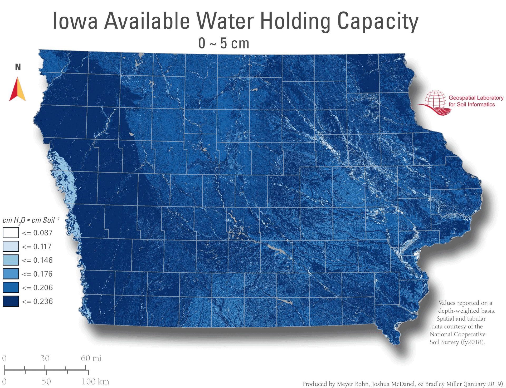
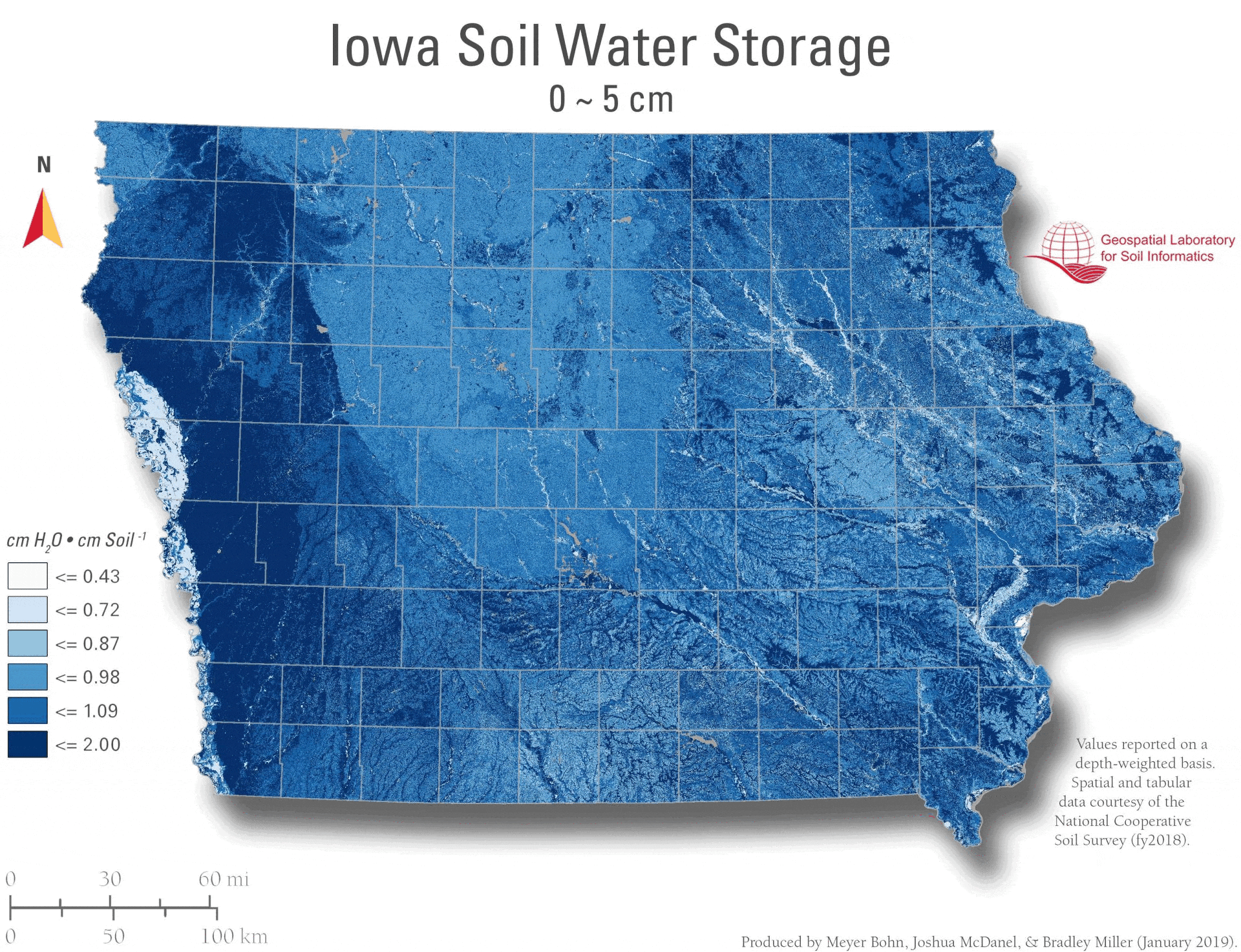
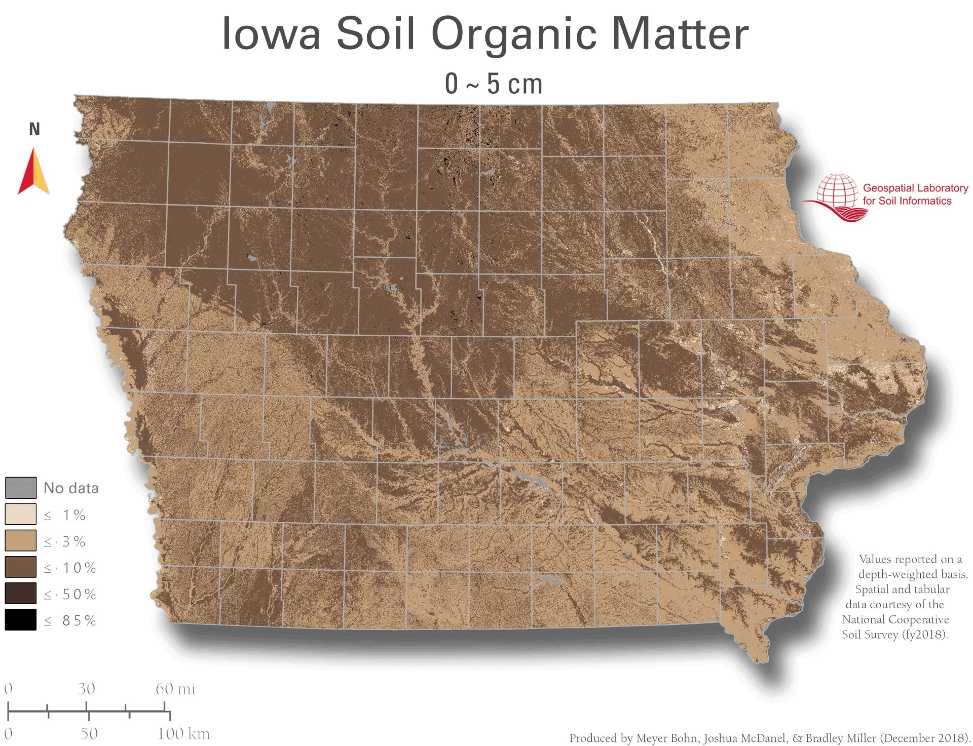
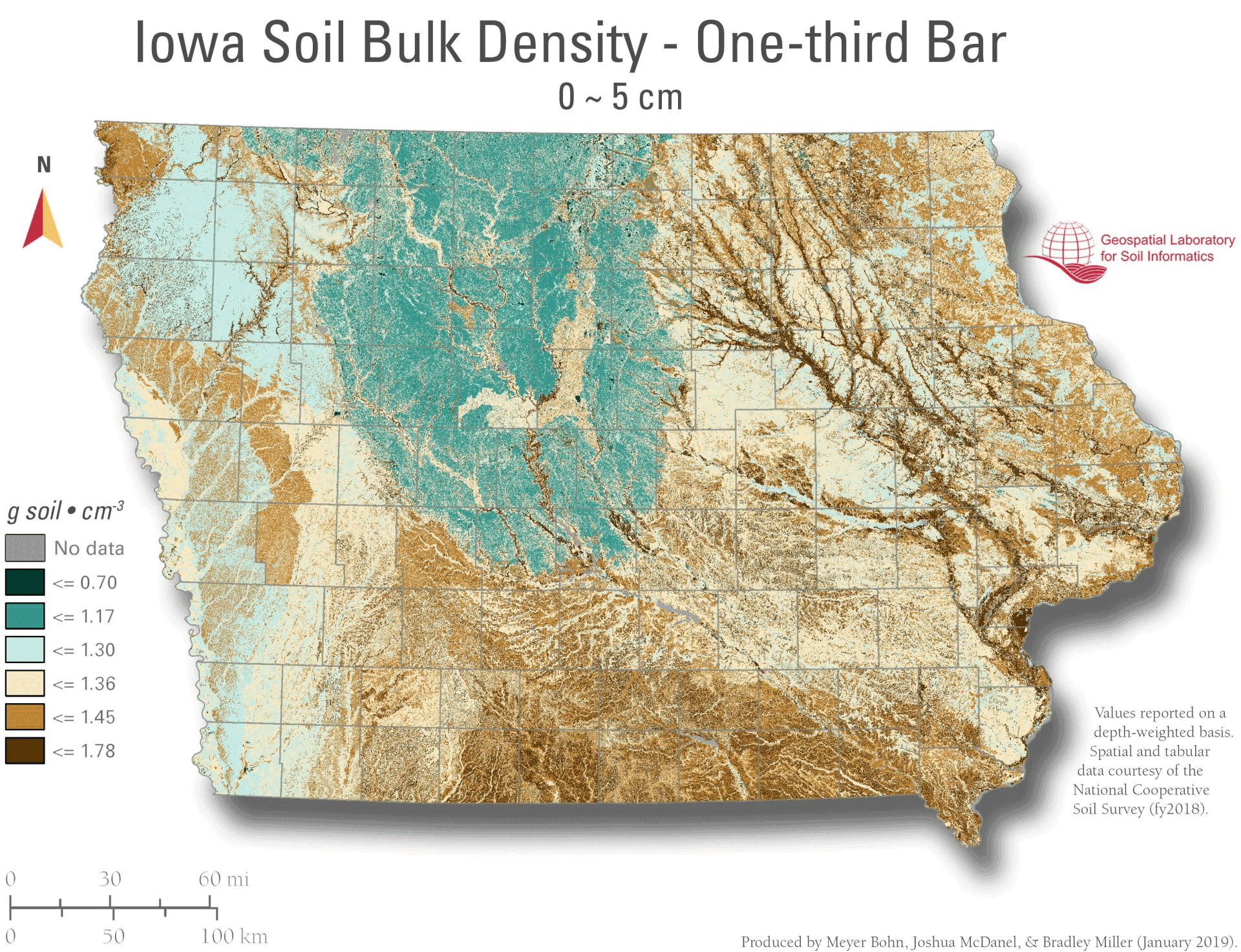
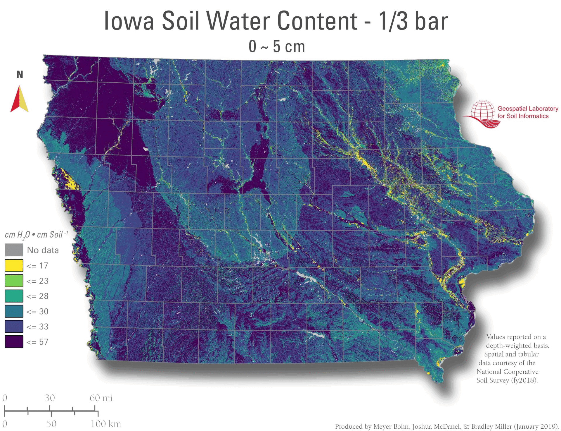
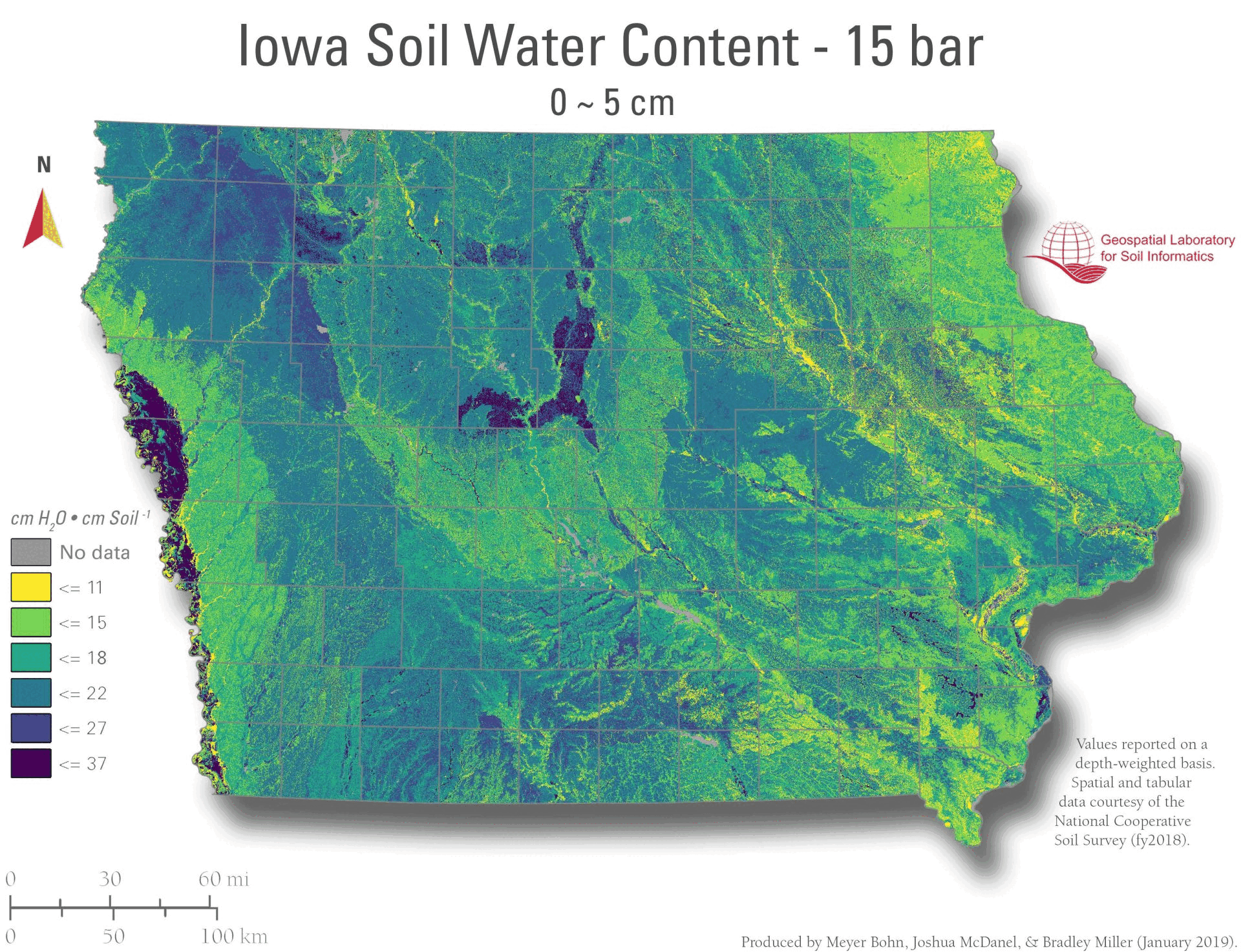
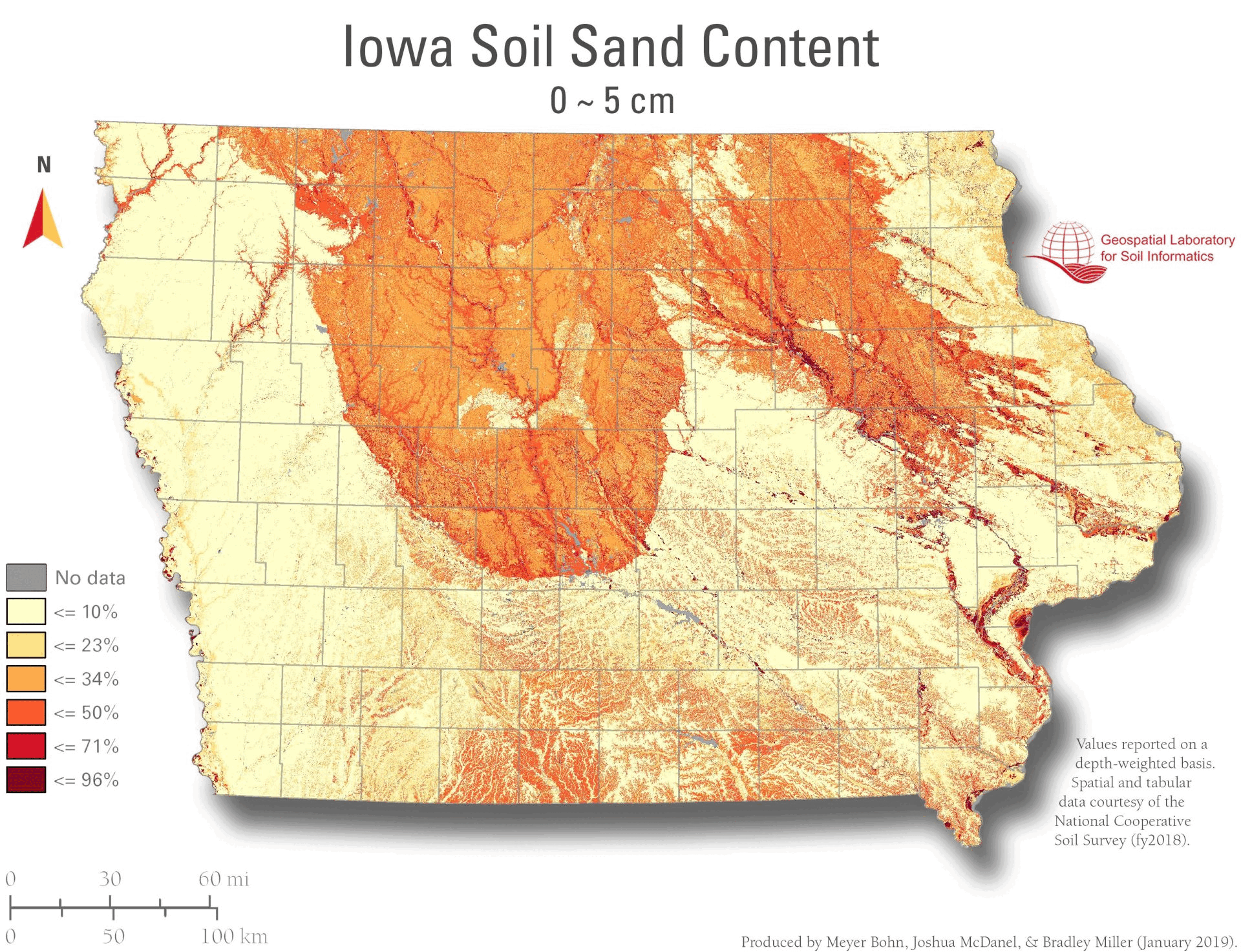
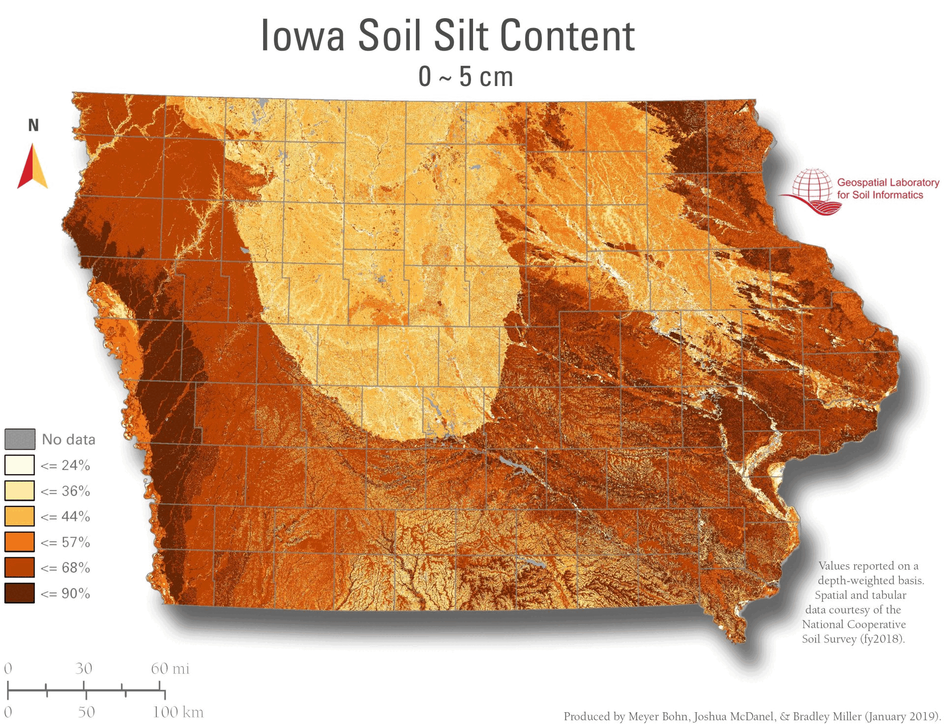
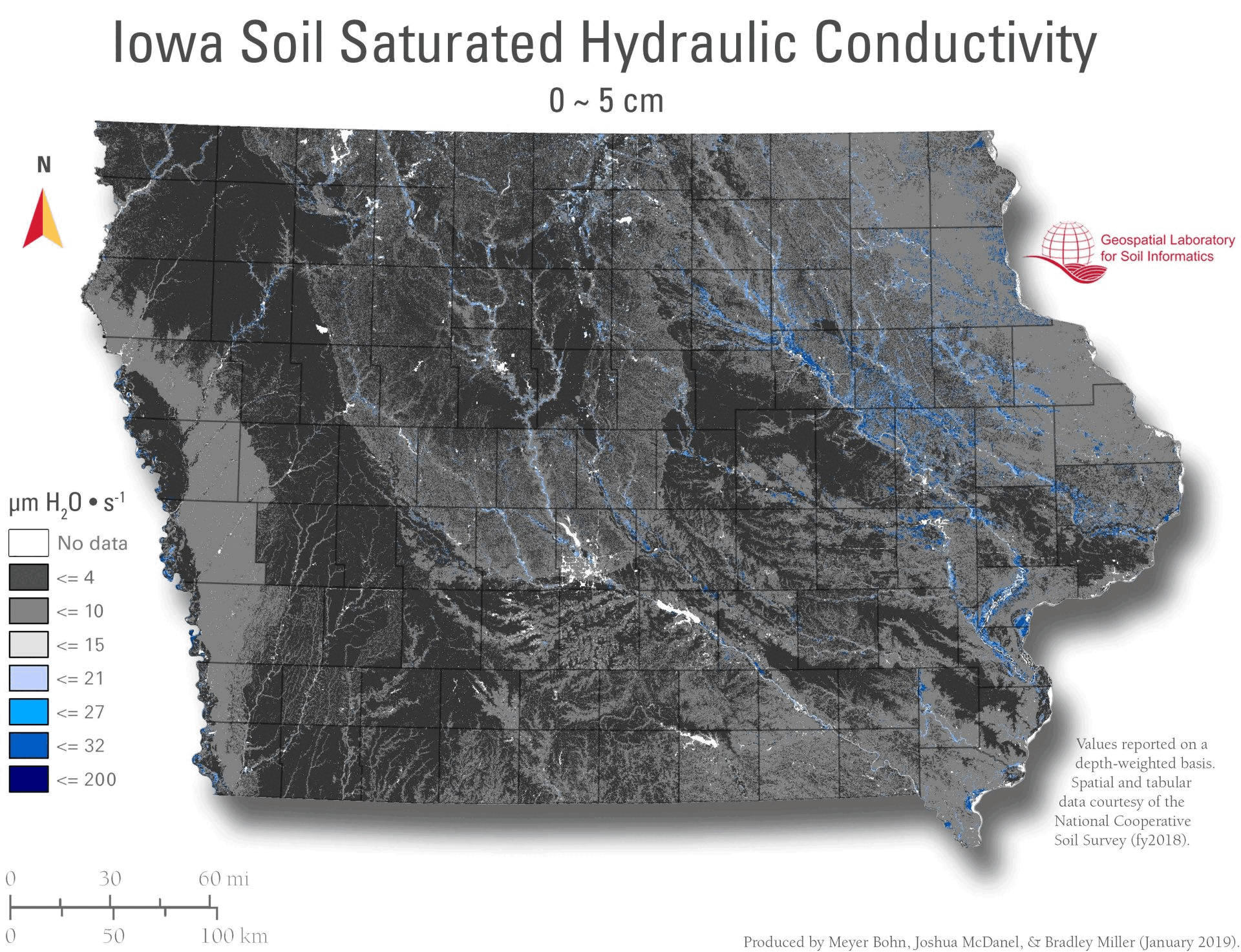
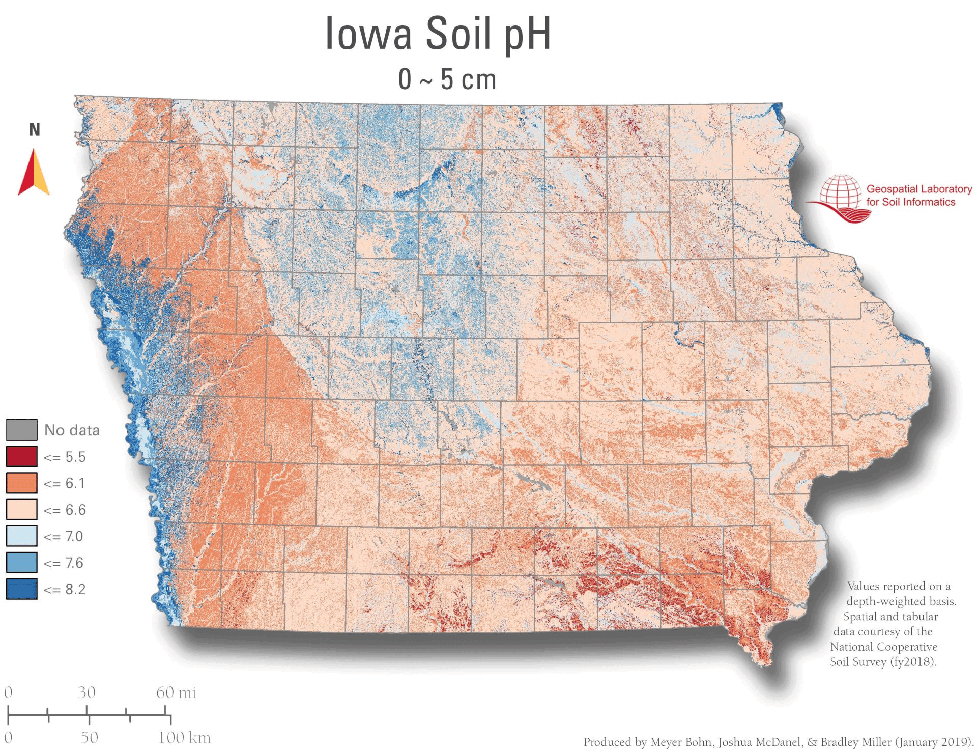
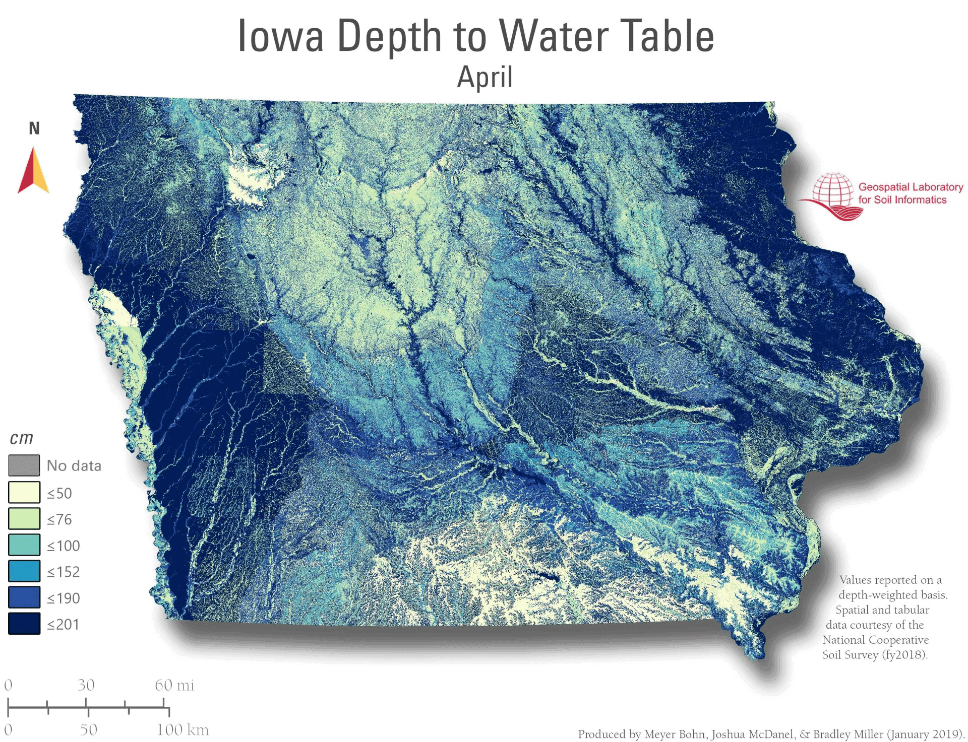
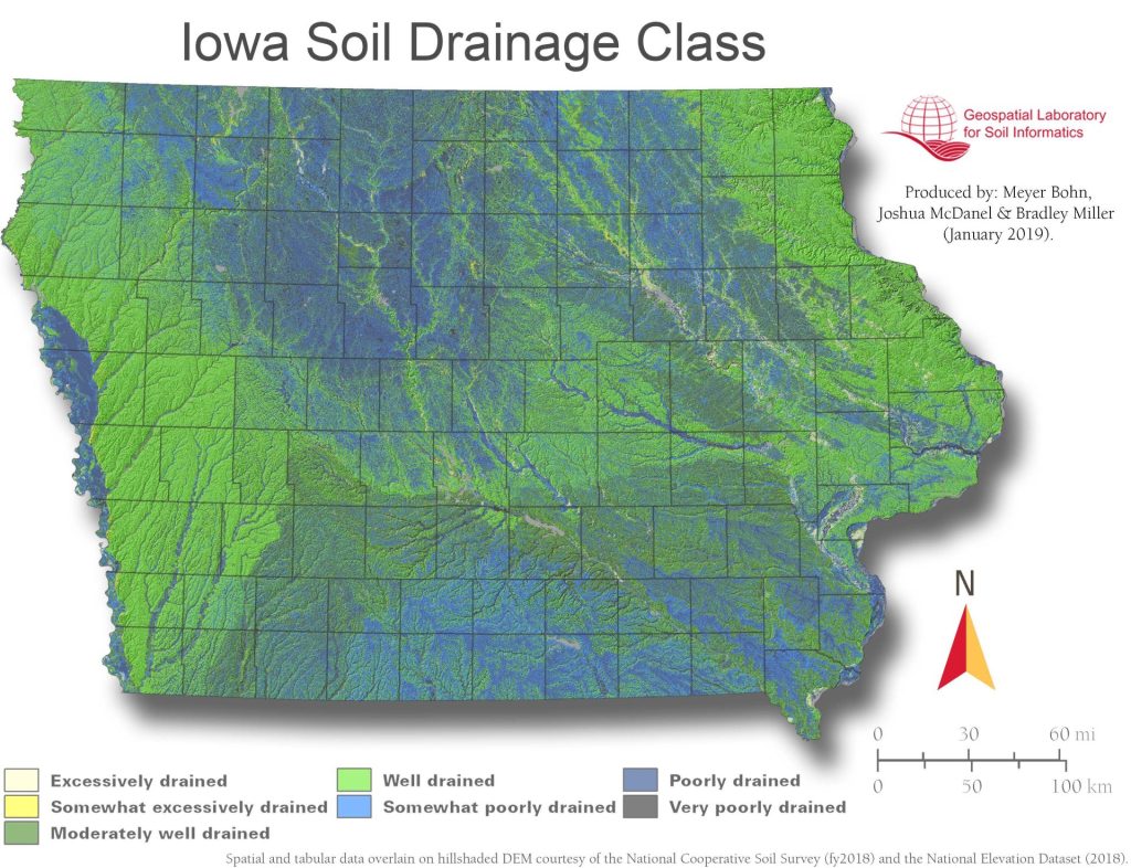
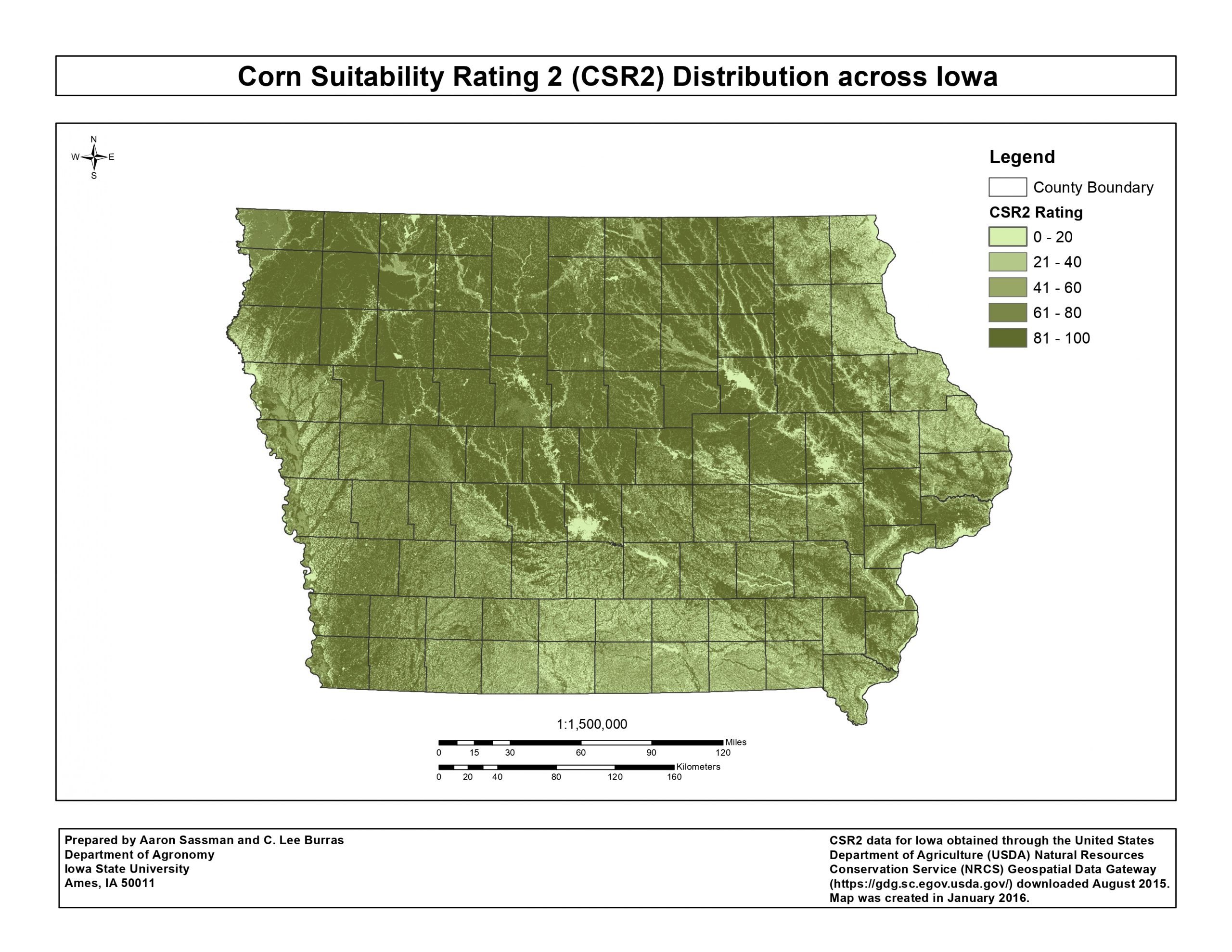
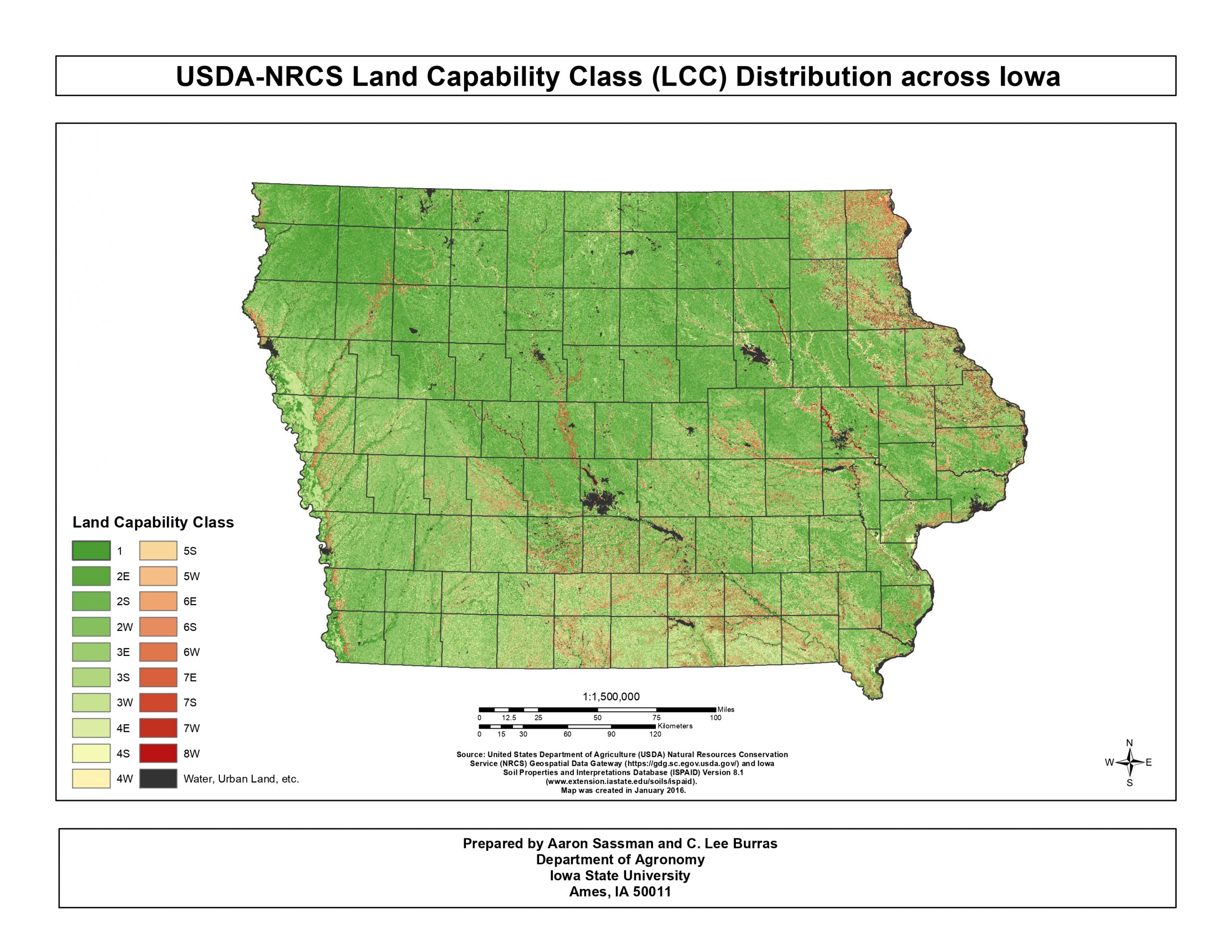
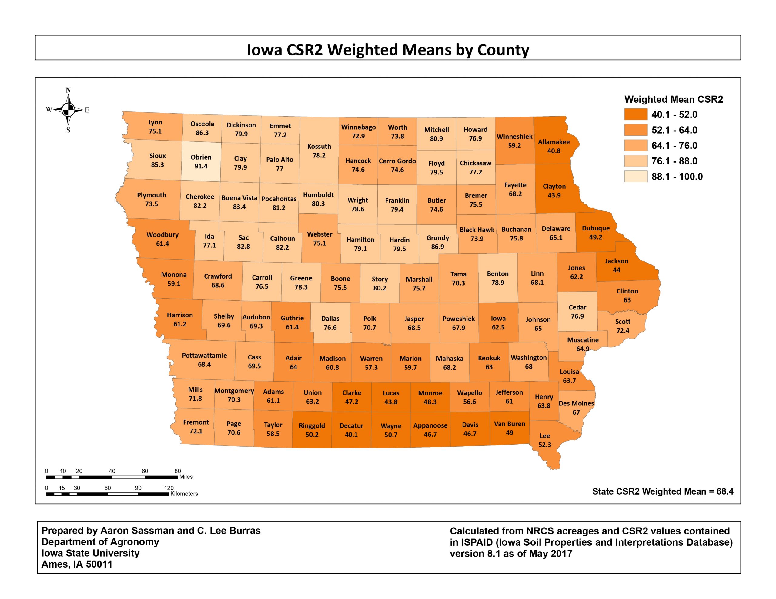
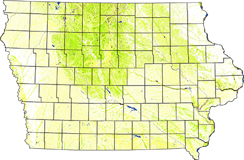
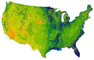
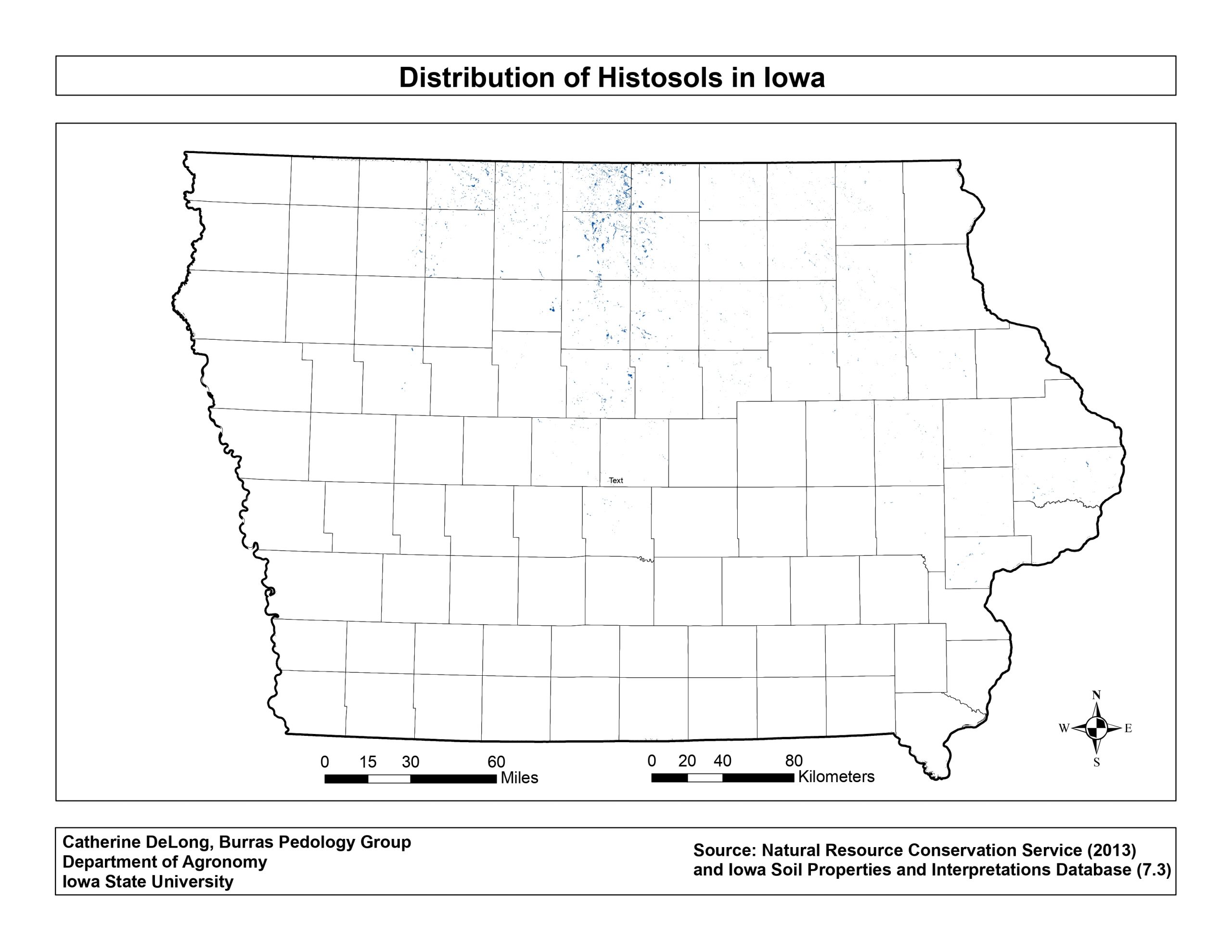
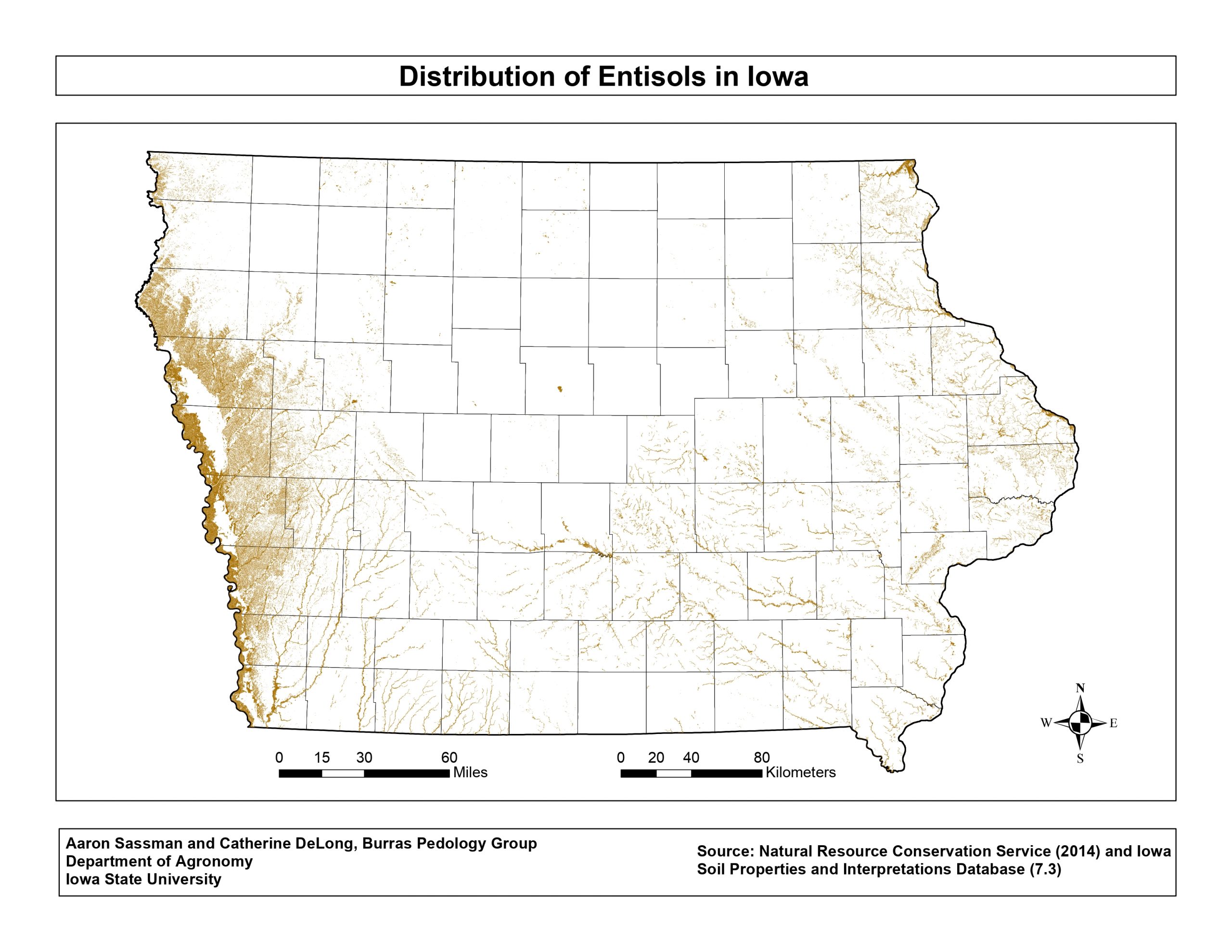
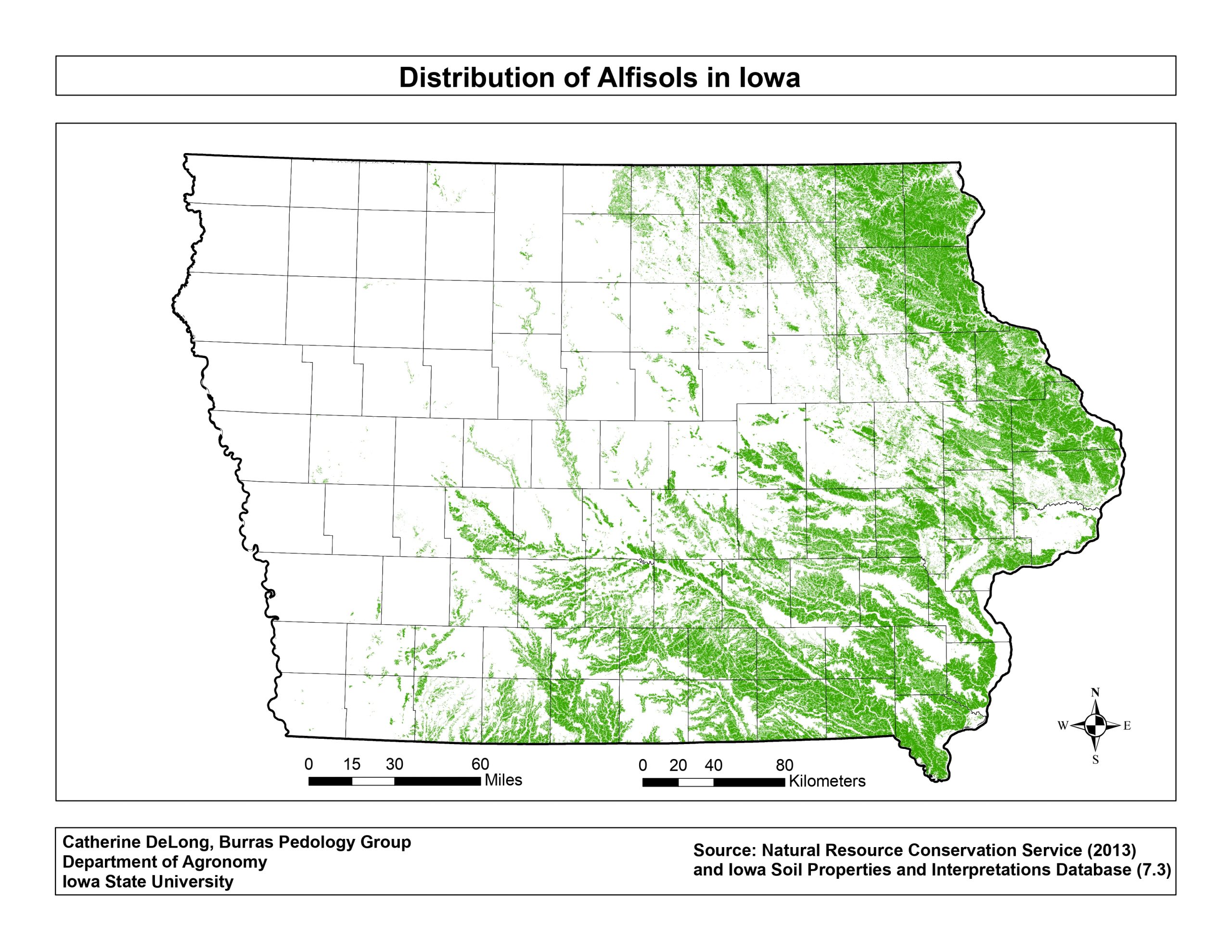
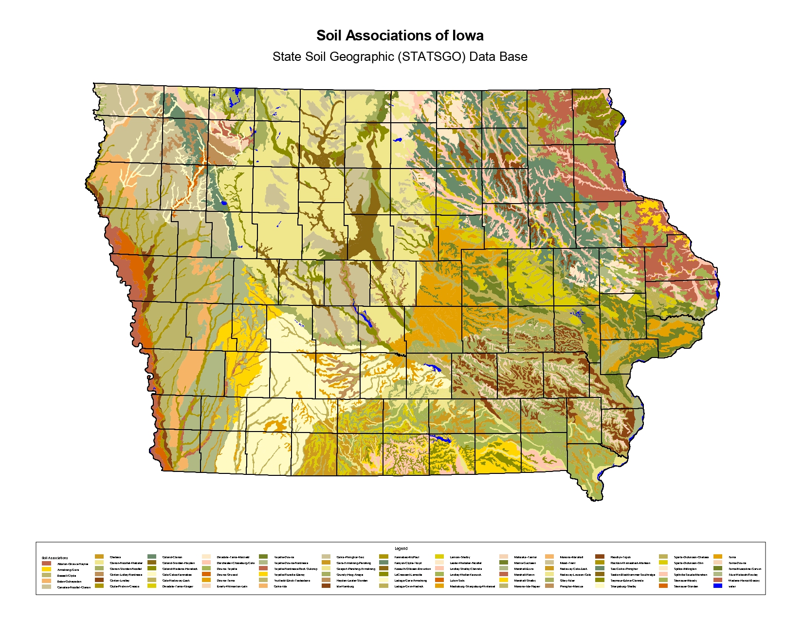
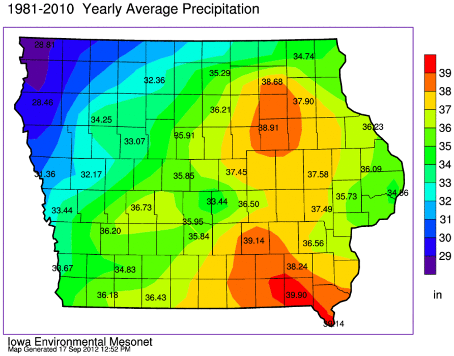
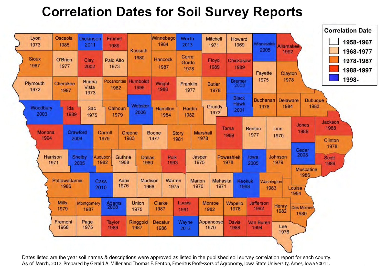
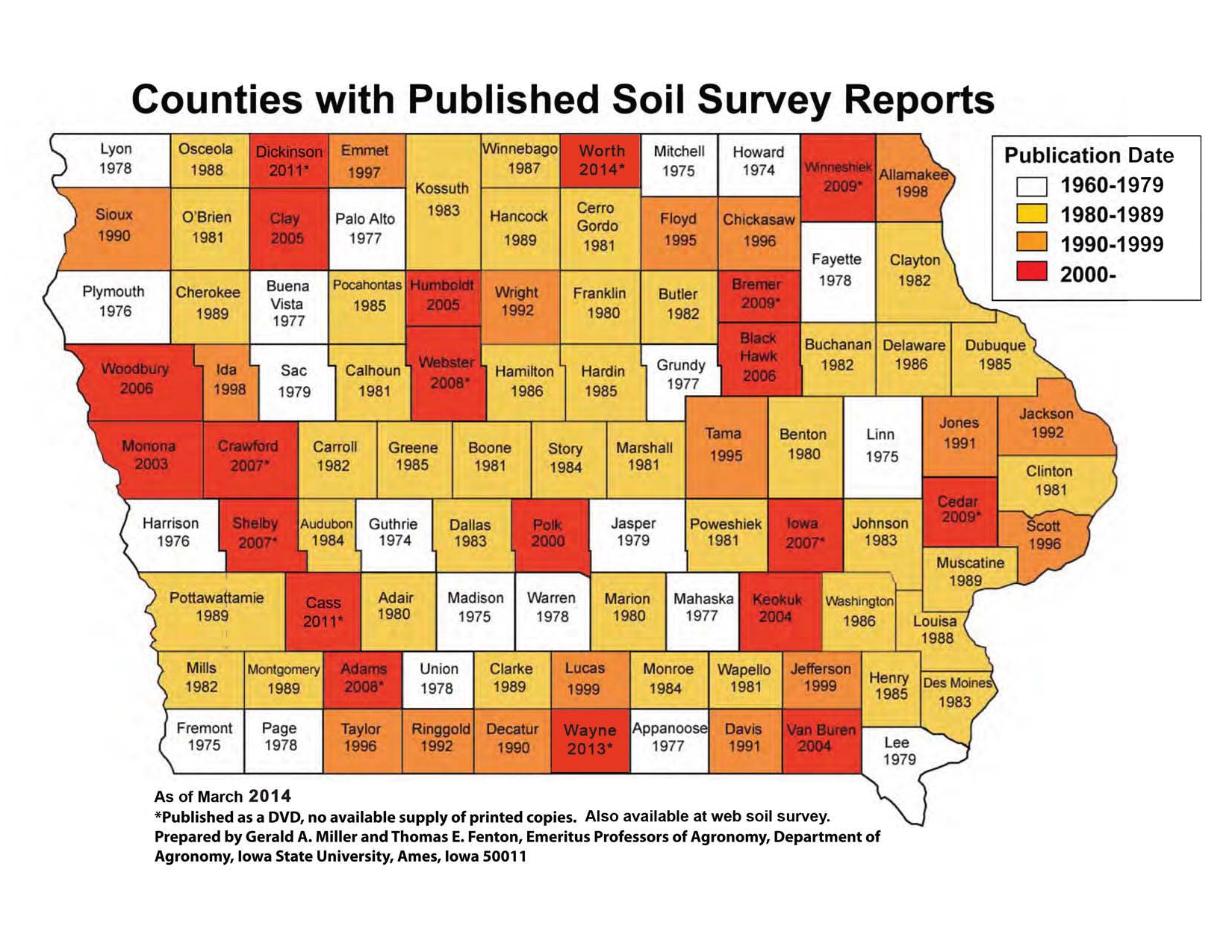
The Image Library contains a collection of static maps and animated GIFs that visually represent key aspects of Iowa’s landscapes and soils. This collection includes maps related to physiography, land use, soil properties, soil interpretations, climate, and soil mapping status. These images serve as accessible visual references for understanding spatial patterns and supporting communication of complex geospatial information in both research and outreach contexts.
Image Library