Skip To Main Content
Geospatial Laboratory for Soil Informatics
Toggle Menu
Close Main Menu
Geospatial Laboratory for Soil Informatics
Services
Particle Size Analysis
Probe Truck
About Us
Research Team
Opportunities
Fieldwork and Trips Gallery
Research
Manuscripts
Analysis Tools
Resources
GIS Data
CEMA 221
Soil Stats
Soilscapes
Soil Profiles
Maps
Academics
Soil Science Certificate
Courses
Search
Submit Search
All Articles
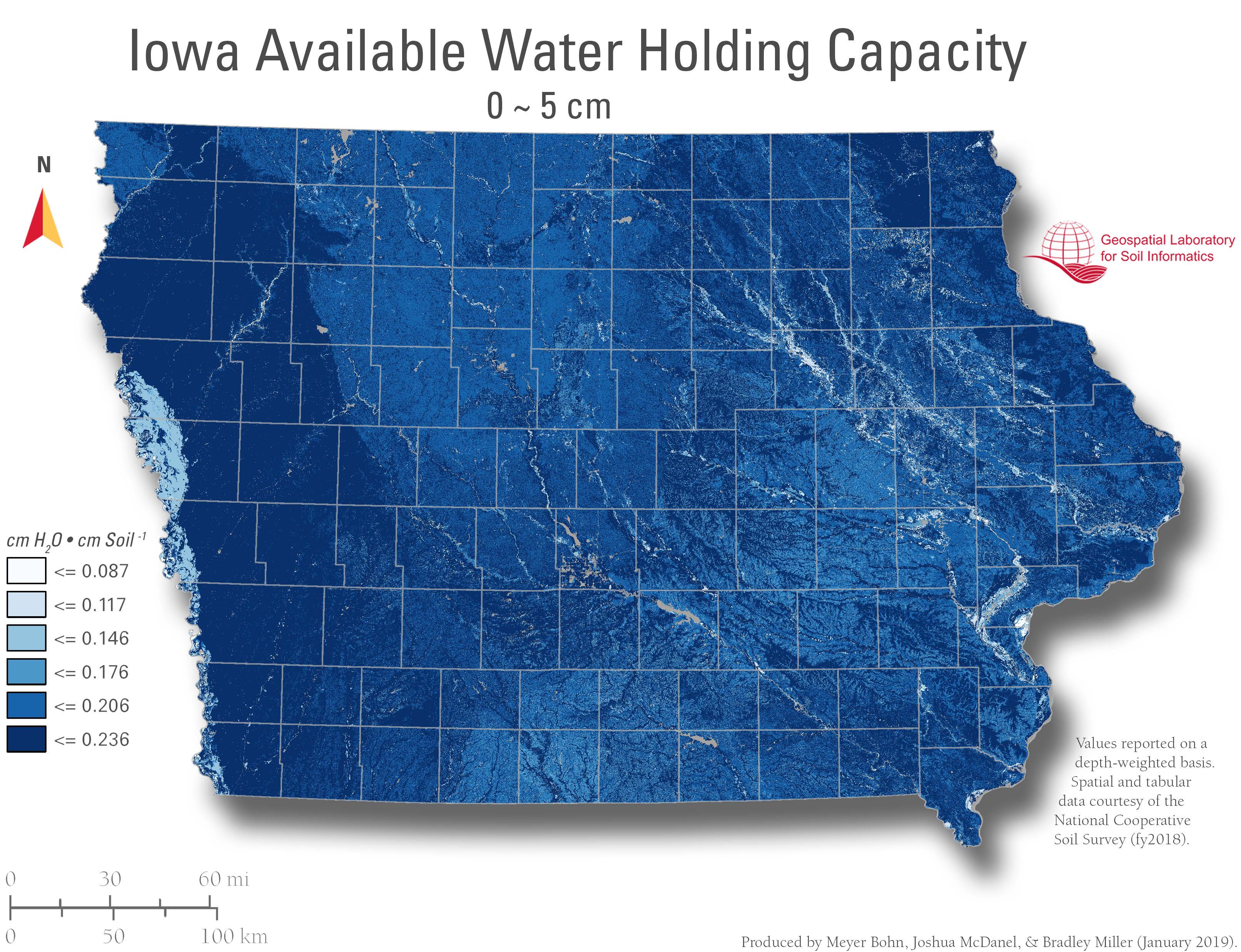
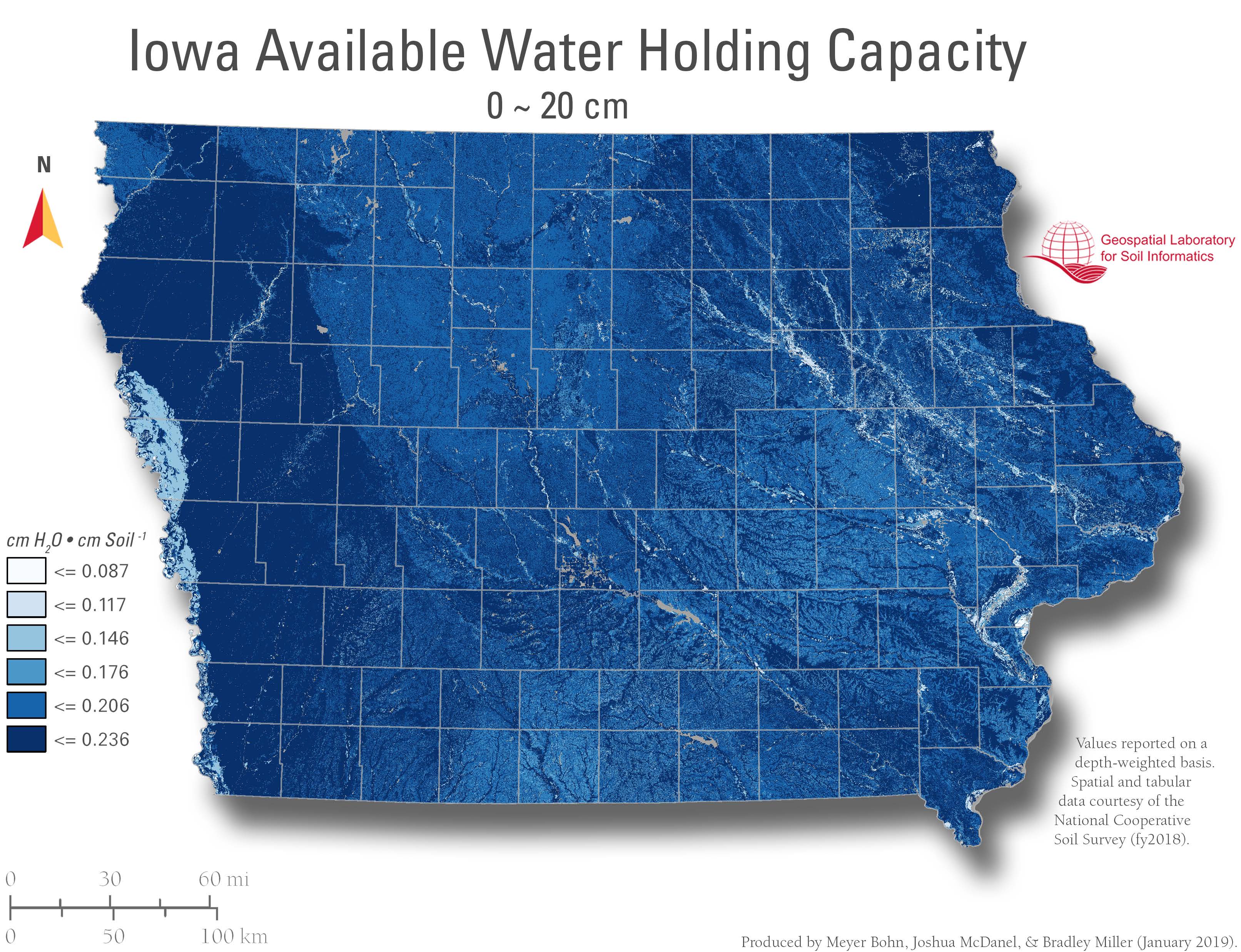
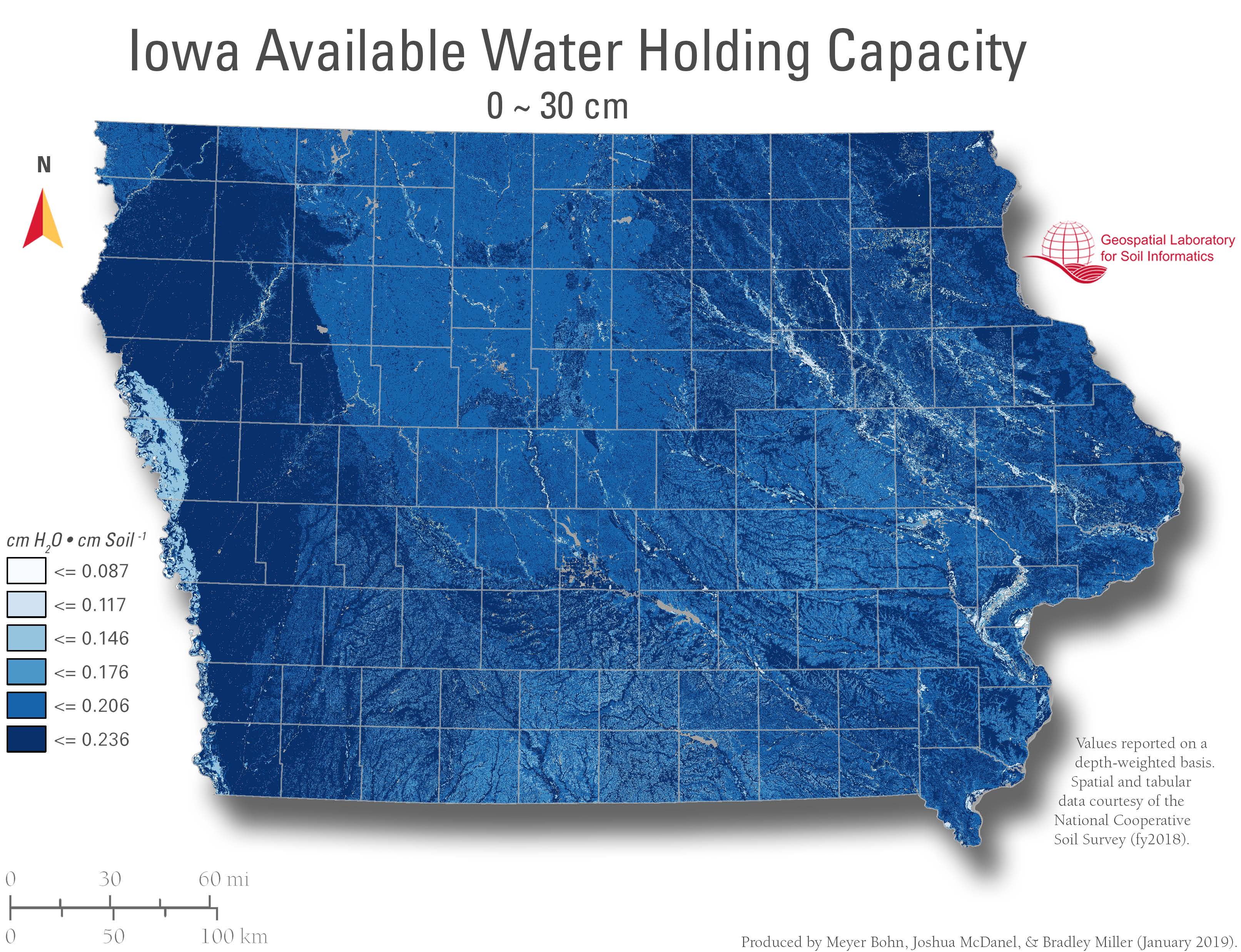
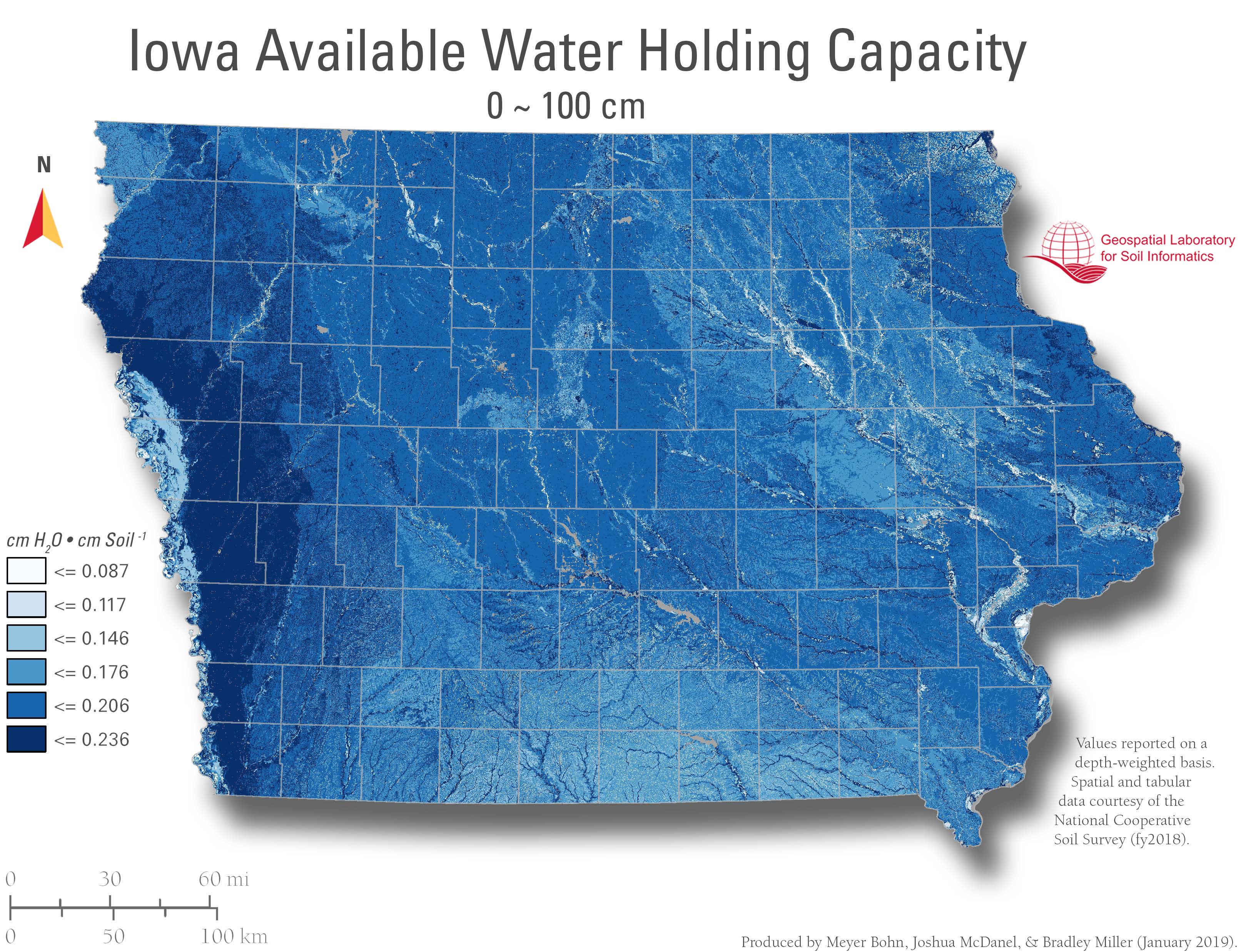
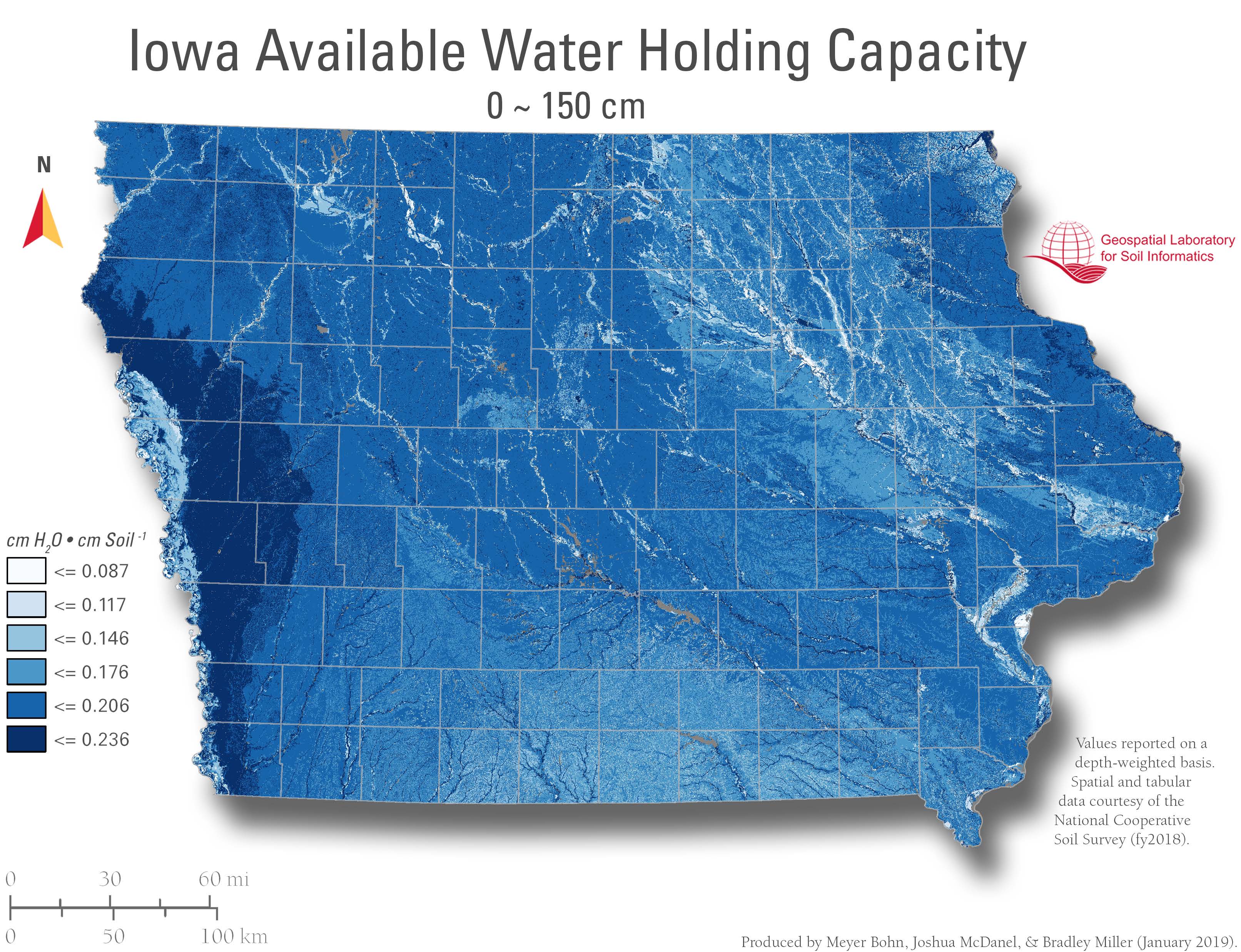
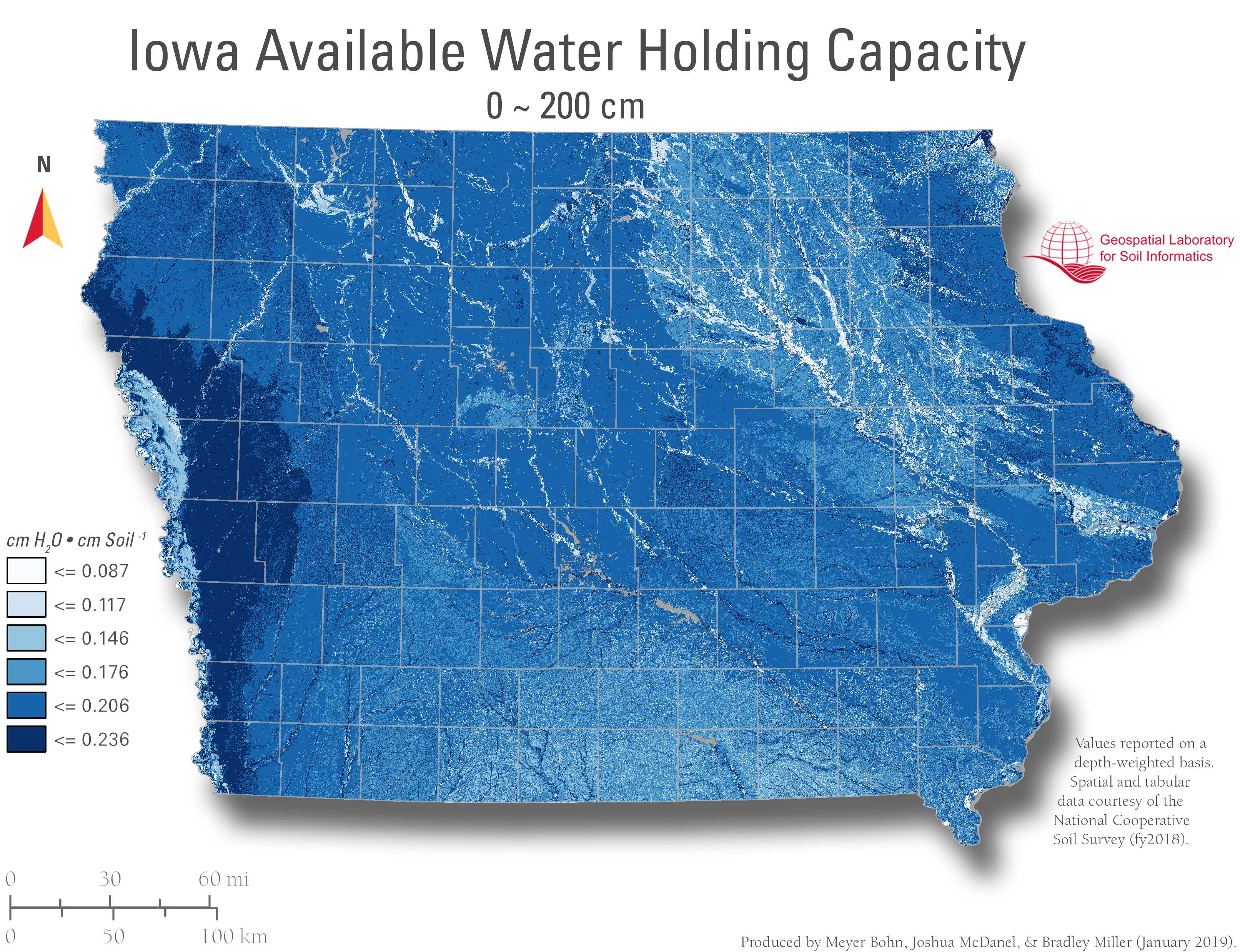
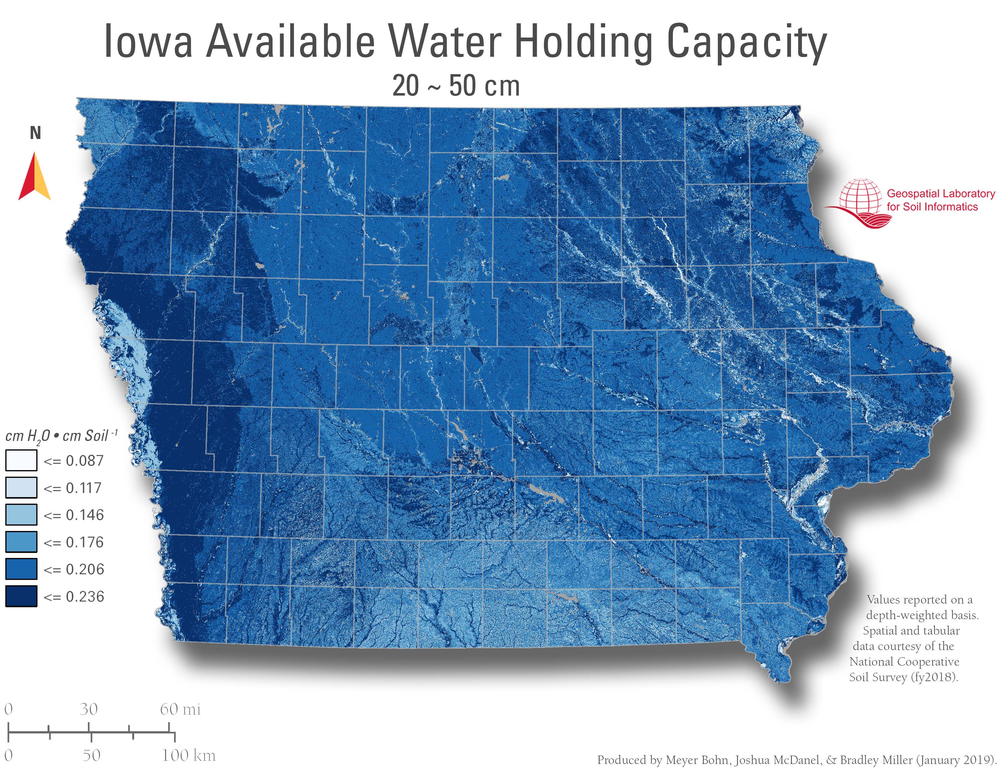
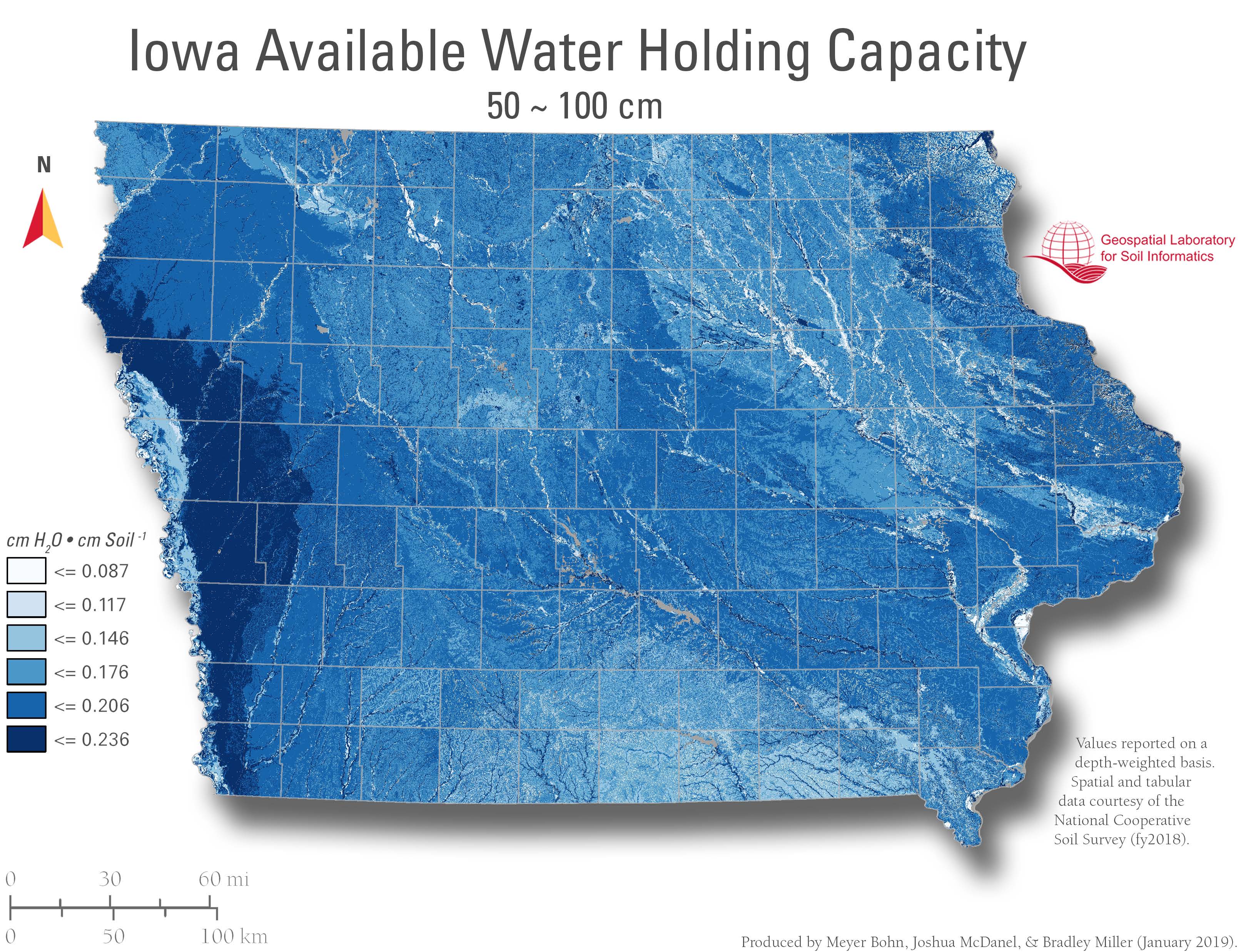
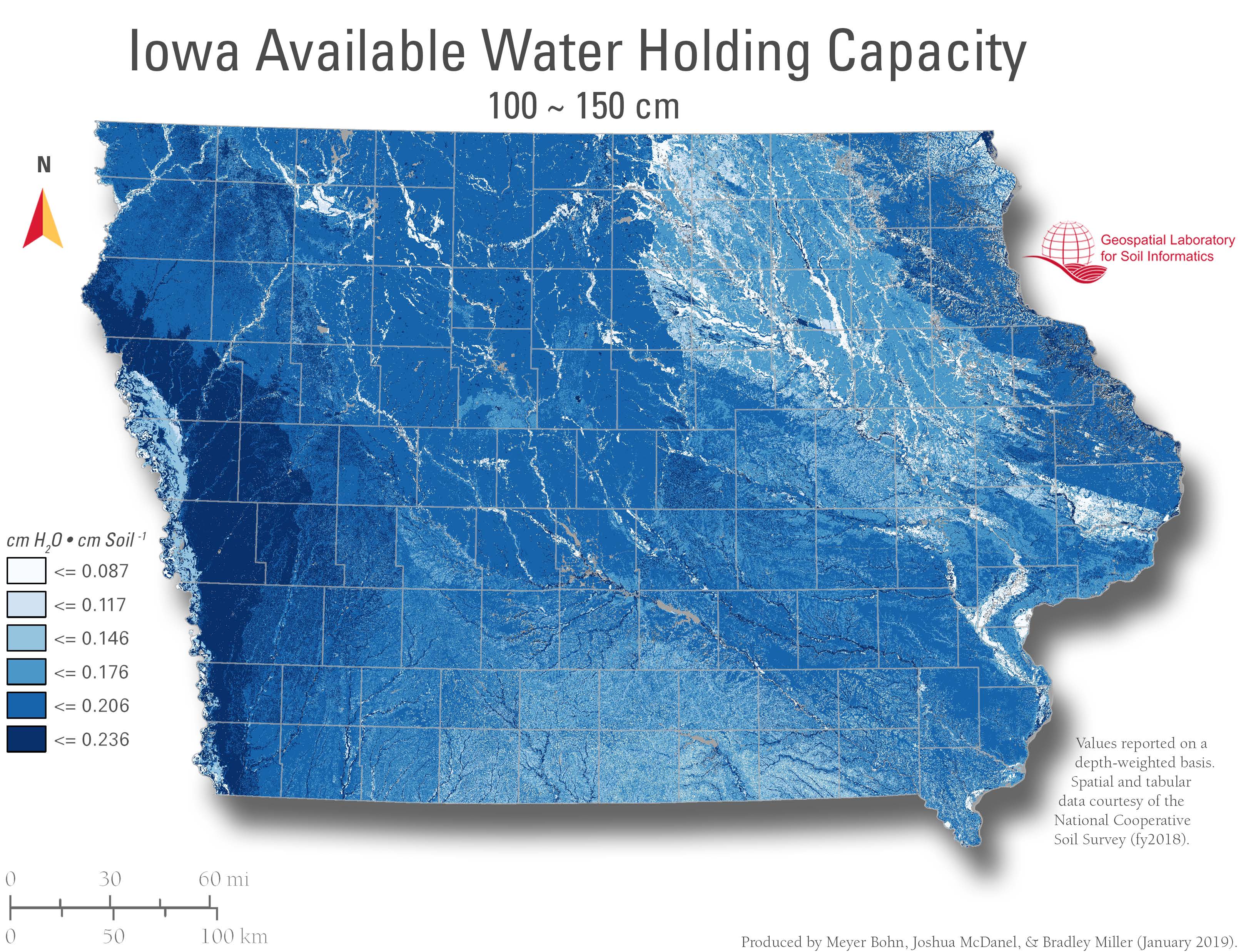
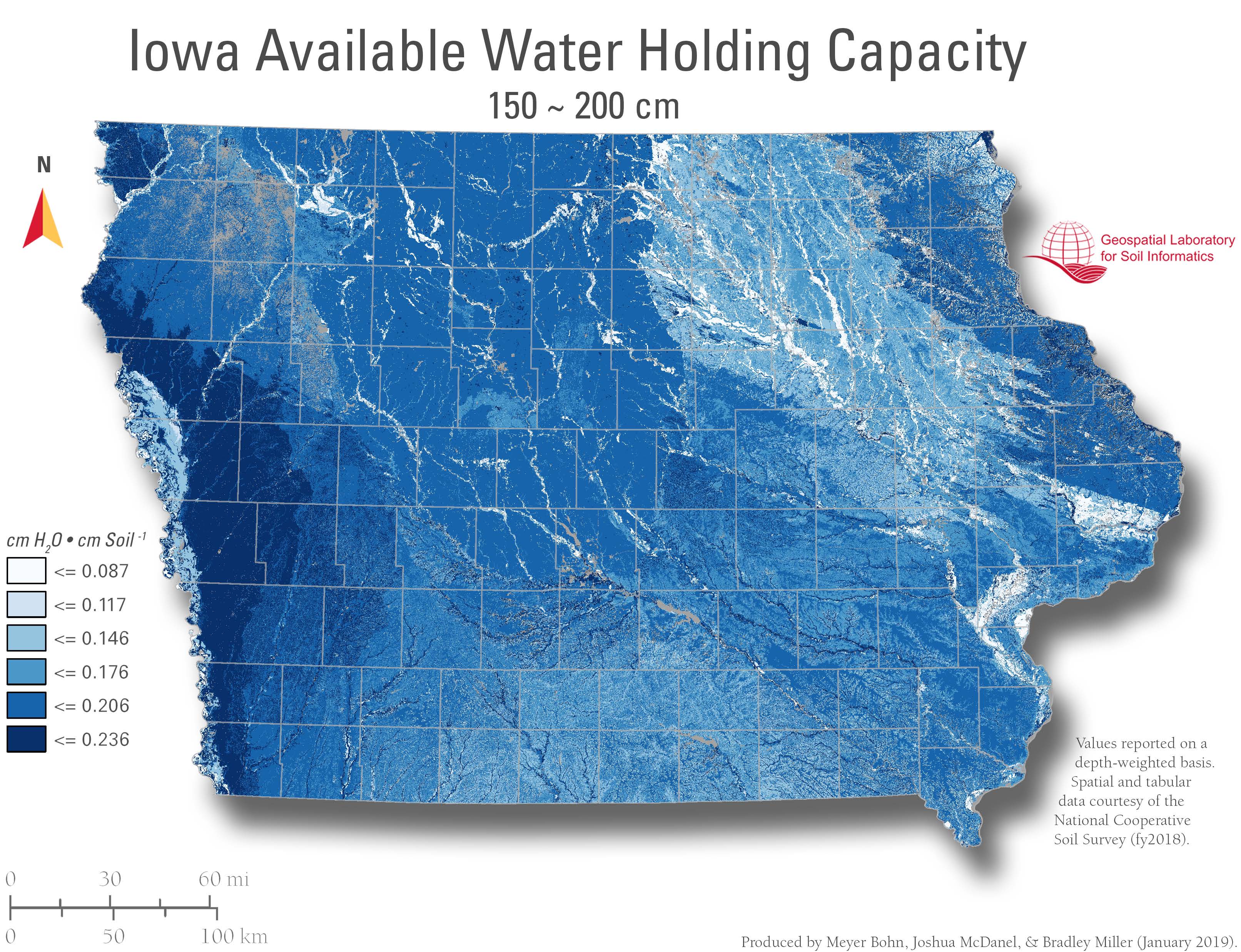
Soil Available Water Capacity – gSSURGO
Author: Meyer Bohn
To download print image, right click within the pop-up gallery view and select “save image as”
aAWC0to5
bAWC0to20
cAWC0to30
dAWC0to100
eAWC0to150
fAWC0to200
gAWC5to20
hAWC20to50
iAWC50to100
jAWC100to150
kAWC150to200
Spread the word:
Facebook
Twitter
LinkedIn
Print
Email
More
Reddit
Pinterest
Tumblr
Telegram
Pocket
WhatsApp
Related
Categories
Maps
Tags
Available Water Holding Capacity
Iowa
Water holding capacity